Distance to Calhoun, Missouri

Calculating Your Route
Just a moment while we process your request...
Location Information
-
Full AddressCalhoun, MO 65323
-
Coordinates38.4672414, -93.6263224
-
LocationCalhoun , Missouri , US
-
TimezoneAmerica/Chicago
-
Current Local Time3:08:49 AM America/ChicagoWednesday, June 25, 2025
-
Page Views0
About Calhoun
Calhoun is a city in Henry County, Missouri, United States. The population was 469 at the 2010 census.


Nearby Places
Found 10 places within 50 miles

Windsor
7.2 mi
11.6 km
Windsor, MO 65360
Get directions

Leeton
8.8 mi
14.2 km
Leeton, MO 64761
Get directions

Clinton
10.7 mi
17.2 km
Clinton, MO 64735
Get directions

Green Ridge
15.8 mi
25.4 km
Green Ridge, MO 65332
Get directions

Deepwater
16.3 mi
26.2 km
Deepwater, MO 64740
Get directions

Lincoln
16.6 mi
26.7 km
Lincoln, MO 65338
Get directions

Whiteman AFB
18.4 mi
29.6 km
Whiteman AFB, MO
Get directions

Warsaw
20.4 mi
32.8 km
Warsaw, MO 65355
Get directions

Knob Noster
21.0 mi
33.8 km
Knob Noster, MO 65336
Get directions

Warrensburg
21.3 mi
34.3 km
Warrensburg, MO 64093
Get directions
Location Links
Local Weather
Weather Information
Coming soon!
Location Map
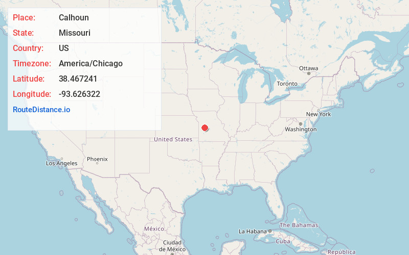
Static map view of Calhoun, Missouri
Browse Places by Distance
Places within specific distances from Calhoun
Short Distances
Long Distances
Click any distance to see all places within that range from Calhoun. Distances shown in miles (1 mile ≈ 1.61 kilometers).