Distance to Call, Texas

Calculating Your Route
Just a moment while we process your request...
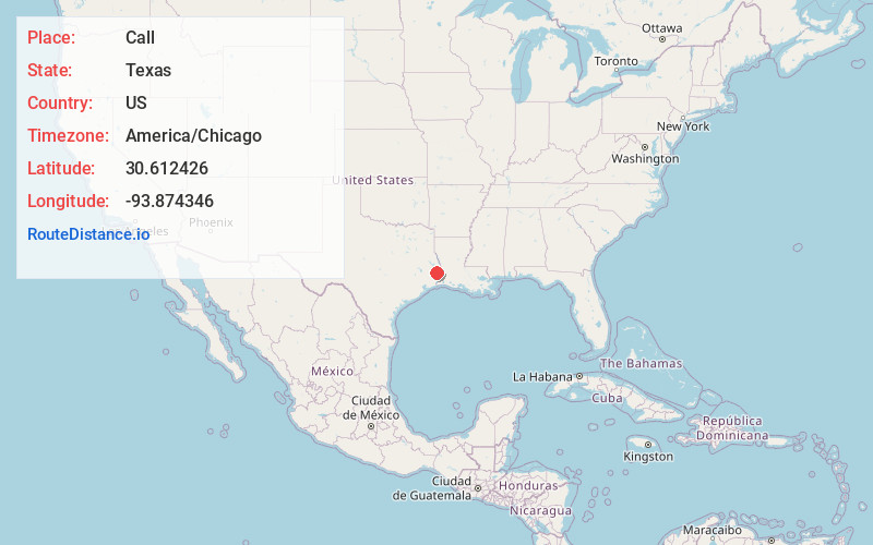
Location Information
-
Full AddressCall, TX 75933
-
Coordinates30.6124261, -93.8743461
-
LocationCall , Texas , US
-
TimezoneAmerica/Chicago
-
Current Local Time10:23:07 PM America/ChicagoSaturday, June 21, 2025
-
Page Views0
About Call
Call is an unincorporated community in central Newton County, Texas, United States. It lies along State Highway 87 south of the city of Newton, the county seat of Newton County.
Nearby Places
Found 10 places within 50 miles

Adsul
2.8 mi
4.5 km
Adsul, TX 75933
Get directions

Kirbyville
3.4 mi
5.5 km
Kirbyville, TX 75956
Get directions
Trout Creek
3.9 mi
6.3 km
Trout Creek, TX 75933
Get directions
Le Verte
6.5 mi
10.5 km
Le Verte, TX 77612
Get directions
Bon Ami
7.0 mi
11.3 km
Bon Ami, TX 75956
Get directions
Mt Union
10.6 mi
17.1 km
Mt Union, TX 75956
Get directions
Bessmay
11.4 mi
18.3 km
Bessmay, Buna, TX 77612
Get directions
Bancroft
11.7 mi
18.8 km
Bancroft, LA 70653
Get directions
Magnolia Springs
12.4 mi
20.0 km
Magnolia Springs, TX 75956
Get directions
Fawil
12.7 mi
20.4 km
Fawil, TX 75928
Get directions
Location Links
Local Weather
Weather Information
Coming soon!
Location Map
Static map view of Call, Texas
Browse Places by Distance
Places within specific distances from Call
Short Distances
Long Distances
Click any distance to see all places within that range from Call. Distances shown in miles (1 mile ≈ 1.61 kilometers).