Distance to Carroll, North Carolina

Calculating Your Route
Just a moment while we process your request...
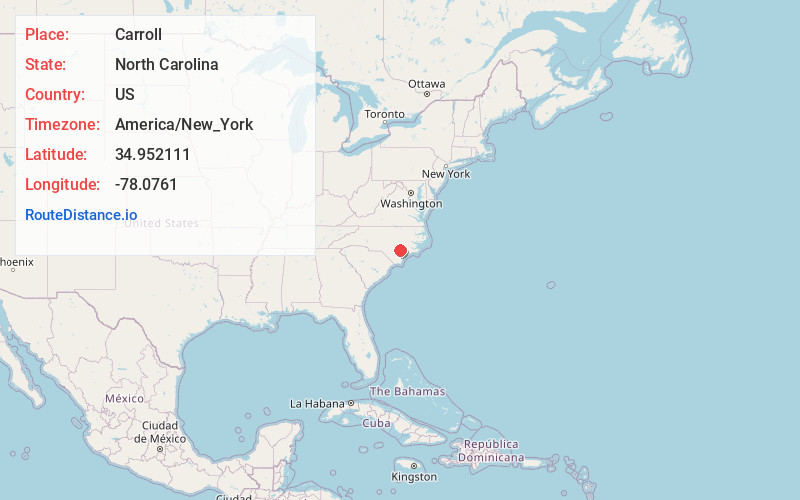
Location Information
-
Full AddressCarroll, NC 28398
-
Coordinates34.9521112, -78.0761002
-
LocationNorth Carolina , US
-
TimezoneAmerica/New_York
-
Current Local Time9:09:13 AM America/New_YorkMonday, June 23, 2025
-
Page Views0
Nearby Places
Found 10 places within 50 miles

Warsaw
3.4 mi
5.5 km
Warsaw, NC
Get directions

Magnolia
4.0 mi
6.4 km
Magnolia, NC 28453
Get directions
Everton
6.2 mi
10.0 km
Everton, NC 28398
Get directions

Kenansville
6.5 mi
10.5 km
Kenansville, NC 28349
Get directions

Turkey
6.7 mi
10.8 km
Turkey, NC 28393
Get directions
Bowdens
7.6 mi
12.2 km
Bowdens, NC
Get directions
Elliott
8.1 mi
13.0 km
Elliott, NC 28393
Get directions

Rose Hill
9.1 mi
14.6 km
Rose Hill, NC 28458
Get directions

Taylors Bridge Township
11.5 mi
18.5 km
Taylors Bridge Township, NC
Get directions
Duff Creek
11.7 mi
18.8 km
Duff Creek, NC 28464
Get directions
Location Links
Local Weather
Weather Information
Coming soon!
Location Map
Static map view of Carroll, North Carolina
Browse Places by Distance
Places within specific distances from Carroll
Short Distances
Long Distances
Click any distance to see all places within that range from Carroll. Distances shown in miles (1 mile ≈ 1.61 kilometers).