Distance to Clemson, South Carolina

Calculating Your Route
Just a moment while we process your request...
Location Information
-
Full AddressClemson, SC
-
Coordinates34.6834382, -82.8373654
-
LocationClemson , South Carolina , US
-
TimezoneAmerica/New_York
-
Current Local Time1:27:20 AM America/New_YorkMonday, June 30, 2025
-
Website
-
Page Views0
About Clemson
Clemson is a city in Pickens and Anderson counties in the U.S. state of South Carolina. Clemson is adjacent to Clemson University, and is identified with it. In 2015, the Princeton Review cited the town of Clemson as ranking #1 in the United States for "town-and-gown" relations with its resident university.


Nearby Places
Found 8 places within 50 miles

Anderson
16.4 mi
26.4 km
Anderson, SC
Get directions

Easley
16.8 mi
27.0 km
Easley, SC
Get directions

Greenville
27.3 mi
43.9 km
Greenville, SC
Get directions

Mauldin
30.7 mi
49.4 km
Mauldin, SC
Get directions

Wade Hampton
32.4 mi
52.1 km
Wade Hampton, SC
Get directions

Simpsonville
33.3 mi
53.6 km
Simpsonville, SC
Get directions

Taylors
34.8 mi
56.0 km
Taylors, SC
Get directions

Greer
38.9 mi
62.6 km
Greer, SC
Get directions
Location Links
Local Weather
Weather Information
Coming soon!
Location Map
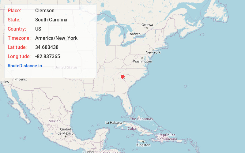
Static map view of Clemson, South Carolina
Browse Places by Distance
Places within specific distances from Clemson
Short Distances
Long Distances
Click any distance to see all places within that range from Clemson. Distances shown in miles (1 mile ≈ 1.61 kilometers).