Distance to Clewiston, Florida

Calculating Your Route
Just a moment while we process your request...
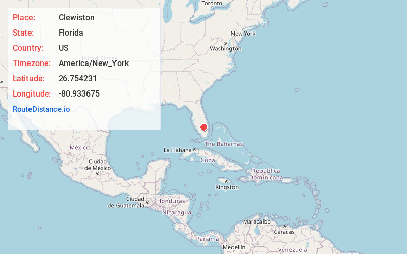
Location Information
-
Full AddressClewiston, FL 33440
-
Coordinates26.7542312, -80.9336753
-
LocationClewiston , Florida , US
-
TimezoneAmerica/New_York
-
Current Local Time10:22:23 PM America/New_YorkThursday, June 19, 2025
-
Page Views0
About Clewiston
Clewiston is a city in Hendry County, Florida, United States. Its location is 80 miles northwest of Fort Lauderdale on the Atlantic coastal plain. The population was 7,327 at the 2020 census, up from 7,155 at the 2010 census. It is the principal city in the Clewiston micropolitan area.


Nearby Places
Found 5 places within 50 miles

Belle Glade
17.1 mi
27.5 km
Belle Glade, FL
Get directions

Wellington
41.6 mi
66.9 km
Wellington, FL
Get directions

The Acreage
41.9 mi
67.4 km
The Acreage, FL
Get directions

Lehigh Acres
43.6 mi
70.2 km
Lehigh Acres, FL
Get directions

Jupiter Farms
47.6 mi
76.6 km
Jupiter Farms, FL 33478
Get directions
Location Links
Local Weather
Weather Information
Coming soon!
Location Map
Static map view of Clewiston, Florida
Browse Places by Distance
Places within specific distances from Clewiston
Short Distances
Long Distances
Click any distance to see all places within that range from Clewiston. Distances shown in miles (1 mile ≈ 1.61 kilometers).