Distance to Cookstown, Virginia

Calculating Your Route
Just a moment while we process your request...
Location Information
-
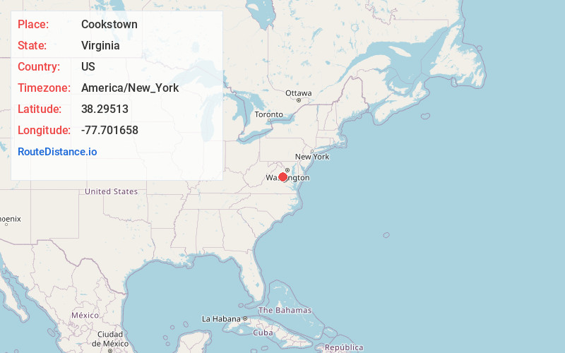
Full AddressCookstown, VA 22553
-
Coordinates38.2951302, -77.7016575
-
LocationVirginia , US
-
TimezoneAmerica/New_York
-
Current Local Time10:45:29 PM America/New_YorkTuesday, July 1, 2025
-
Page Views0
About Cookstown
Cookstown is an unincorporated community in Spotsylvania County, in the U.S. state of Virginia.
Nearby Places
Found 10 places within 50 miles

Hazel Grove
2.7 mi
4.3 km
Hazel Grove, VA 22553
Get directions
Todds Tavern
3.7 mi
6.0 km
Todds Tavern, VA 22553
Get directions
Chancellor
5.5 mi
8.9 km
Chancellor, VA 22407
Get directions

Locust Grove
6.0 mi
9.7 km
Locust Grove, VA 22508
Get directions
Gold Dale
6.0 mi
9.7 km
Gold Dale, VA 22508
Get directions

Spotsylvania County
8.1 mi
13.0 km
Spotsylvania County, VA
Get directions
Panier
8.6 mi
13.8 km
Panier, VA 22551
Get directions
Soapstone Branch
9.1 mi
14.6 km
Soapstone Branch, Virginia 22542
Get directions
Pine View
10.6 mi
17.1 km
Pine View, VA 22742
Get directions
Southern Gateway
11.3 mi
18.2 km
Southern Gateway, VA 22406
Get directions
Location Links
Local Weather
Weather Information
Coming soon!
Location Map
Static map view of Cookstown, Virginia
Browse Places by Distance
Places within specific distances from Cookstown
Short Distances
Long Distances
Click any distance to see all places within that range from Cookstown. Distances shown in miles (1 mile ≈ 1.61 kilometers).