Distance to Destrehan, Louisiana

Calculating Your Route
Just a moment while we process your request...
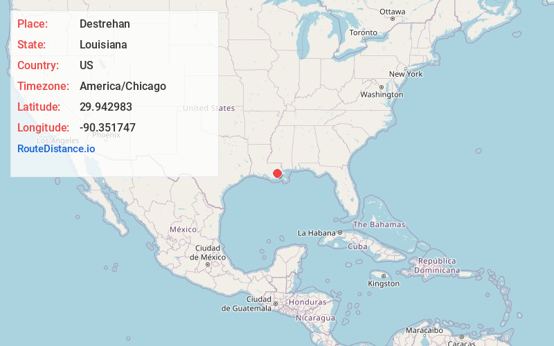
Location Information
-
Full AddressDestrehan, LA
-
Coordinates29.9429828, -90.3517469
-
LocationDestrehan , Louisiana , US
-
TimezoneAmerica/Chicago
-
Current Local Time8:30:25 AM America/ChicagoThursday, June 12, 2025
-
Page Views0
About Destrehan
Destrehan is an unincorporated community and census-designated place in St. Charles Parish, Louisiana, United States. At the 2020 census, its population was 11,340. It is located on the east bank of the Mississippi River. Destrehan is part of the New Orleans—Metairie—Kenner metropolitan statistical area.


Nearby Places
Found 10 places within 50 miles

Luling
1.2 mi
1.9 km
Luling, LA
Get directions

Kenner
7.5 mi
12.1 km
Kenner, LA
Get directions

River Ridge
8.2 mi
13.2 km
River Ridge, LA
Get directions

Laplace
11.5 mi
18.5 km
Laplace, LA
Get directions

Metairie
12.2 mi
19.6 km
Metairie, LA
Get directions

Marrero
15.4 mi
24.8 km
Marrero, LA 70072
Get directions

Estelle
16.1 mi
25.9 km
Estelle, LA 70072
Get directions

New Orleans
16.5 mi
26.6 km
New Orleans, LA
Get directions

Harvey
16.7 mi
26.9 km
Harvey, LA
Get directions

Gretna
17.9 mi
28.8 km
Gretna, LA
Get directions
Location Links
Local Weather
Weather Information
Coming soon!
Location Map
Static map view of Destrehan, Louisiana
Browse Places by Distance
Places within specific distances from Destrehan
Short Distances
Long Distances
Click any distance to see all places within that range from Destrehan. Distances shown in miles (1 mile ≈ 1.61 kilometers).