Distance to Eielson AFB, Alaska

Calculating Your Route
Just a moment while we process your request...
Location Information
-
Full AddressEielson AFB, AK
-
Coordinates64.6638356, -147.0992191
-
LocationEielson AFB , Alaska , US
-
TimezoneAmerica/Anchorage
-
Current Local Time5:50:05 PM America/AnchorageWednesday, June 18, 2025
-
Website
-
Page Views0
About Eielson AFB
Eielson Air Force Base is a United States Air Force base located approximately 26 miles southeast of Fairbanks, Alaska, and just southeast of Moose Creek, Alaska. It was established in 1943 as Mile 26 Satellite Field and redesignated Eielson Air Force Base on 13 January 1948. It has been a Superfund site since 1989.


Nearby Places
Found 6 places within 50 miles

Badger
13.4 mi
21.6 km
Badger, AK
Get directions
Steele Creek
18.9 mi
30.4 km
Steele Creek, AK 99712
Get directions

Fairbanks
22.0 mi
35.4 km
Fairbanks, AK
Get directions
Farmers Loop
23.7 mi
38.1 km
Farmers Loop, AK
Get directions
College
24.9 mi
40.1 km
College, AK 99709
Get directions

Chena
27.4 mi
44.1 km
Chena, AK 99709
Get directions
Location Links
Local Weather
Weather Information
Coming soon!
Location Map
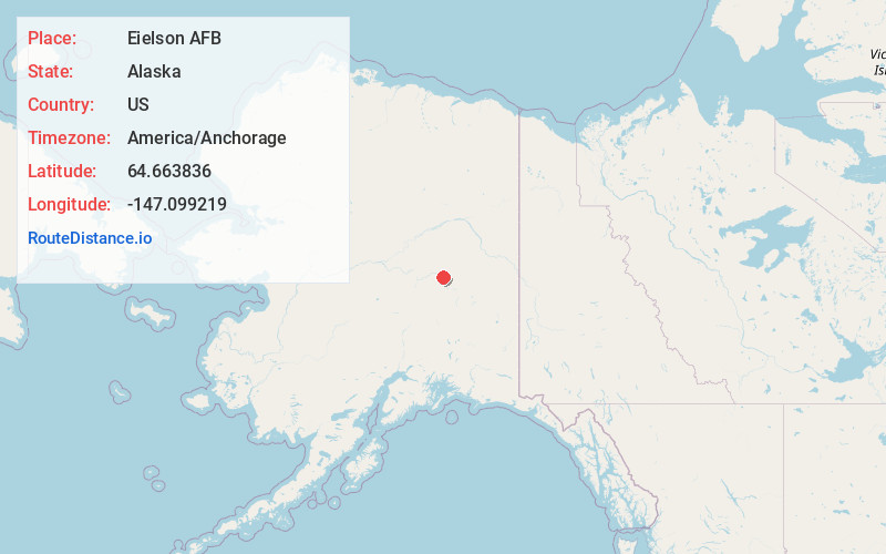
Static map view of Eielson AFB, Alaska
Browse Places by Distance
Places within specific distances from Eielson AFB
Short Distances
Long Distances
Click any distance to see all places within that range from Eielson AFB. Distances shown in miles (1 mile ≈ 1.61 kilometers).