Distance to Everett Springs, Georgia

Calculating Your Route
Just a moment while we process your request...
Location Information
-
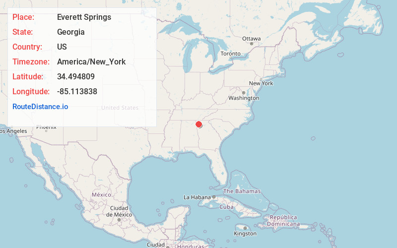
Full AddressEverett Springs, GA 30105
-
Coordinates34.4948088, -85.1138377
-
LocationGeorgia , US
-
TimezoneAmerica/New_York
-
Current Local Time7:20:17 AM America/New_YorkTuesday, July 1, 2025
-
Page Views0
Nearby Places
Found 10 places within 50 miles

Rosedale
3.9 mi
6.3 km
Rosedale, GA 30701
Get directions
Curryville
4.1 mi
6.6 km
Curryville, GA 30701
Get directions
Floyd Springs
5.3 mi
8.5 km
Floyd Springs, GA 30105
Get directions
Beatum
6.2 mi
10.0 km
Beatum, GA 30747
Get directions
Subligna
6.2 mi
10.0 km
Subligna, GA 30747
Get directions
Reeves
6.2 mi
10.0 km
Reeves, GA 30701
Get directions

East Armuchee Creek
6.6 mi
10.6 km
East Armuchee Creek, Georgia
Get directions
Farmersville
6.7 mi
10.8 km
Farmersville, GA 30105
Get directions

Sugar Valley
7.3 mi
11.7 km
Sugar Valley, GA 30746
Get directions

Plainville
7.6 mi
12.2 km
Plainville, GA 30733
Get directions
Location Links
Local Weather
Weather Information
Coming soon!
Location Map
Static map view of Everett Springs, Georgia
Browse Places by Distance
Places within specific distances from Everett Springs
Short Distances
Long Distances
Click any distance to see all places within that range from Everett Springs. Distances shown in miles (1 mile ≈ 1.61 kilometers).