Distance to Ewing, Virginia

Calculating Your Route
Just a moment while we process your request...
Location Information
-
Full AddressEwing, VA 24248
-
Coordinates36.6367525, -83.4315742
-
LocationEwing , Virginia , US
-
TimezoneAmerica/New_York
-
Current Local Time10:30:36 PM America/New_YorkWednesday, June 18, 2025
-
Page Views0
About Ewing
Ewing is an unincorporated community and census-designated place in Lee County, Virginia, United States. The population was 439 at the 2010 U.S. Census. Ewing is one of the westernmost settlements in the Commonwealth of Virginia, before reaching the Cumberland Gap and the borders with Kentucky and Tennessee.


Nearby Places
Found 10 places within 50 miles

Rose Hill
4.3 mi
6.9 km
Rose Hill, VA 24281
Get directions

South Wallins
12.4 mi
20.0 km
South Wallins, KY 40873
Get directions

Harrogate
13.0 mi
20.9 km
Harrogate, TN
Get directions

Sneedville
14.0 mi
22.5 km
Sneedville, TN 37869
Get directions

Tazewell
14.7 mi
23.7 km
Tazewell, TN 37879
Get directions
Cawood
15.2 mi
24.5 km
Cawood, KY 40815
Get directions

Loyall
15.5 mi
24.9 km
Loyall, KY
Get directions

Harlan
15.5 mi
24.9 km
Harlan, KY
Get directions

Middlesboro
15.8 mi
25.4 km
Middlesboro, KY 40965
Get directions

New Tazewell
16.3 mi
26.2 km
New Tazewell, TN
Get directions
Location Links
Local Weather
Weather Information
Coming soon!
Location Map
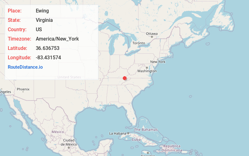
Static map view of Ewing, Virginia
Browse Places by Distance
Places within specific distances from Ewing
Short Distances
Long Distances
Click any distance to see all places within that range from Ewing. Distances shown in miles (1 mile ≈ 1.61 kilometers).