Distance to and from Fort Dupont, District of Columbia
Fort Dupont, Washington, DC 20019
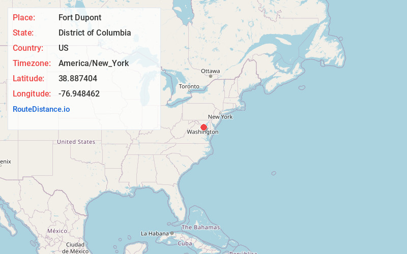
Washington
District of Columbia
US
America/New_York
Location Information
-
Full AddressFort Dupont, Washington, DC 20019
-
Coordinates38.887404, -76.9484624
-
NeighborhoodFort Dupont
-
LocationWashington , District of Columbia , US
-
TimezoneAmerica/New_York
-
Current Local Time6:40:00 PM America/New_YorkSaturday, May 3, 2025
-
Page Views0
Directions to Nearest Cities
Coral Hills
Coral Hills, MD 20743
1.5 mi
Capitol Heights
Capitol Heights, MD 20743
1.8 mi
Fairmount Heights
Fairmount Heights, MD 20743
2.0 mi
Dupont Heights
Dupont Heights, Suitland-Silver Hill, MD 20746
2.2 mi
Maryland Park
Maryland Park, MD 20743
2.2 mi
Suitland Manor
Suitland Manor, Suitland-Silver Hill, MD 20746
2.6 mi
About Fort Dupont
Fort Dupont is a residential neighborhood located in southeast Washington, D.C., east of the Anacostia River. It is bounded by East Capitol Street to the north, Fort Dupont Park to the south, Minnesota Avenue to the west, and Fort Chaplin Park to the east and northeast.
Nearby Places
Found 10 places within 50 miles

Coral Hills
1.5 mi
2.4 km
Coral Hills, MD 20743
Get directions

Capitol Heights
1.8 mi
2.9 km
Capitol Heights, MD 20743
Get directions
Fairmount Heights
2.0 mi
3.2 km
Fairmount Heights, MD 20743
Get directions
Dupont Heights
2.2 mi
3.5 km
Dupont Heights, Suitland-Silver Hill, MD 20746
Get directions
Maryland Park
2.2 mi
3.5 km
Maryland Park, MD 20743
Get directions
Suitland Manor
2.6 mi
4.2 km
Suitland Manor, Suitland-Silver Hill, MD 20746
Get directions

Suitland-Silver Hill
3.1 mi
5.0 km
Suitland-Silver Hill, MD
Get directions
Colmar Manor
3.2 mi
5.1 km
Colmar Manor, MD
Get directions
Cheverly
3.3 mi
5.3 km
Cheverly, MD
Get directions

Walker Mill
3.4 mi
5.5 km
Walker Mill, MD
Get directions
Coral Hills
1.5 mi
2.4 km
Coral Hills, MD 20743
Capitol Heights
1.8 mi
2.9 km
Capitol Heights, MD 20743
Fairmount Heights
2.0 mi
3.2 km
Fairmount Heights, MD 20743
Dupont Heights
2.2 mi
3.5 km
Dupont Heights, Suitland-Silver Hill, MD 20746
Maryland Park
2.2 mi
3.5 km
Maryland Park, MD 20743
Suitland Manor
2.6 mi
4.2 km
Suitland Manor, Suitland-Silver Hill, MD 20746
Suitland-Silver Hill
3.1 mi
5.0 km
Suitland-Silver Hill, MD
Colmar Manor
3.2 mi
5.1 km
Colmar Manor, MD
Cheverly
3.3 mi
5.3 km
Cheverly, MD
Walker Mill
3.4 mi
5.5 km
Walker Mill, MD
Location Links
Local Weather
Weather Information
Coming soon!
Location Map
Static map view of Fort Dupont, District of Columbia
Browse Places by Distance
Places within specific distances from Fort Dupont
Short Distances
Long Distances
Click any distance to see all places within that range from Fort Dupont. Distances shown in miles (1 mile ≈ 1.61 kilometers).