Distance to Fort Edward, New York

Calculating Your Route
Just a moment while we process your request...
Location Information
-
Full AddressFort Edward, NY 12828
-
Coordinates43.2670175, -73.5845597
-
LocationFort Edward , New York , US
-
TimezoneAmerica/New_York
-
Current Local Time5:25:18 AM America/New_YorkWednesday, June 18, 2025
-
Website
-
Page Views0
About Fort Edward
Fort Edward is a village in Washington County, New York, United States. It is part of the Glens Falls Metropolitan Statistical Area. The village population was 3,375 at the 2010 census. The name is derived from the younger brother of King George III, Edward Augustus, Duke of York and Albany.


Nearby Places
Found 10 places within 50 miles

Hudson Falls
2.3 mi
3.7 km
Hudson Falls, NY 12839
Get directions

Glens Falls
4.2 mi
6.8 km
Glens Falls, NY
Get directions

West Glens Falls
4.8 mi
7.7 km
West Glens Falls, NY
Get directions

Queensbury
7.3 mi
11.7 km
Queensbury, NY
Get directions

Corinth
12.6 mi
20.3 km
Corinth, NY 12822
Get directions

Saratoga Springs
16.2 mi
26.1 km
Saratoga Springs, NY
Get directions

Greenfield Center
16.3 mi
26.2 km
Greenfield Center, NY 12833
Get directions

Stillwater
23.0 mi
37.0 km
Stillwater, NY
Get directions

Schaghticoke
25.4 mi
40.9 km
Schaghticoke, NY 12154
Get directions

Ballston
25.7 mi
41.4 km
Ballston, NY
Get directions
Location Links
Local Weather
Weather Information
Coming soon!
Location Map
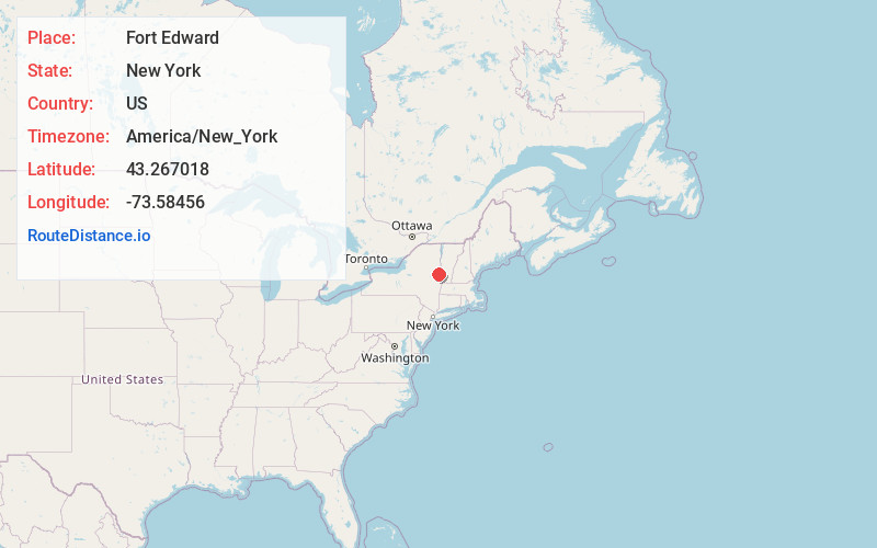
Static map view of Fort Edward, New York
Browse Places by Distance
Places within specific distances from Fort Edward
Short Distances
Long Distances
Click any distance to see all places within that range from Fort Edward. Distances shown in miles (1 mile ≈ 1.61 kilometers).