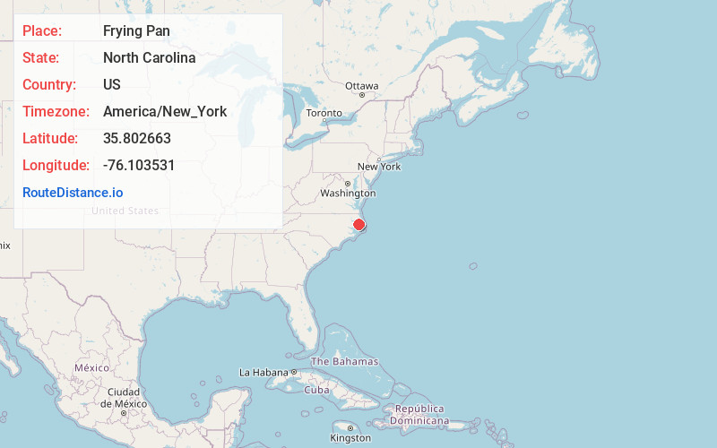
Distance to Frying Pan, North Carolina

Calculating Your Route
Just a moment while we process your request...
Location Information
-
Full AddressFrying Pan, NC 27925
-
Coordinates35.8026628, -76.1035305
-
LocationNorth Carolina , US
-
TimezoneAmerica/New_York
-
Current Local Time2:25:27 PM America/New_YorkTuesday, June 17, 2025
-
Page Views0

Nearby Places
Found 10 places within 50 miles

Columbia
11.5 mi
18.5 km
Columbia, NC 27925
Get directions

Creswell
16.8 mi
27.0 km
Creswell, NC 27928
Get directions

Fairfield
19.3 mi
31.1 km
Fairfield, NC 27826
Get directions
Manns Harbor
20.0 mi
32.2 km
Manns Harbor, NC 27953
Get directions

Engelhard
21.1 mi
34.0 km
Engelhard, NC 27824
Get directions

Manteo
25.0 mi
40.2 km
Manteo, NC 27954
Get directions

Wanchese
26.2 mi
42.2 km
Wanchese, NC 27981
Get directions

Harbinger
26.3 mi
42.3 km
Harbinger, NC 27941
Get directions
Winslow
26.6 mi
42.8 km
Winslow, NC 27909
Get directions

Kill Devil Hills
28.6 mi
46.0 km
Kill Devil Hills, NC 27948
Get directions
Location Links
Local Weather
Weather Information
Coming soon!
Location Map
Static map view of Frying Pan, North Carolina
Browse Places by Distance
Places within specific distances from Frying Pan
Short Distances
Long Distances
Click any distance to see all places within that range from Frying Pan. Distances shown in miles (1 mile ≈ 1.61 kilometers).