Distance to Hampden, Maine

Calculating Your Route
Just a moment while we process your request...
Location Information
-
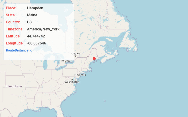
Full AddressHampden, ME
-
Coordinates44.744742, -68.8376456
-
LocationHampden , Maine , US
-
TimezoneAmerica/New_York
-
Current Local Time3:51:57 PM America/New_YorkThursday, June 19, 2025
-
Website
-
Page Views0
About Hampden
Hampden is a town on the Penobscot River estuary in Penobscot County, Maine, United States. The population was 7,709 at the 2020 census. Hampden is part of the Bangor metropolitan statistical area.


Nearby Places
Found 7 places within 50 miles

Bangor
5.1 mi
8.2 km
Bangor, ME 04401
Get directions

Brewer
5.2 mi
8.4 km
Brewer, ME 04412
Get directions

Orono
12.5 mi
20.1 km
Orono, ME 04473
Get directions

Ellsworth
24.7 mi
39.8 km
Ellsworth, ME 04605
Get directions

Winslow
41.1 mi
66.1 km
Winslow, ME 04901
Get directions

Waterville
41.2 mi
66.3 km
Waterville, ME
Get directions

Skowhegan
43.3 mi
69.7 km
Skowhegan, ME 04976
Get directions
Location Links
Local Weather
Weather Information
Coming soon!
Location Map
Static map view of Hampden, Maine
Browse Places by Distance
Places within specific distances from Hampden
Short Distances
Long Distances
Click any distance to see all places within that range from Hampden. Distances shown in miles (1 mile ≈ 1.61 kilometers).