Distance to Hazeldell, Delaware

Calculating Your Route
Just a moment while we process your request...
Location Information
-
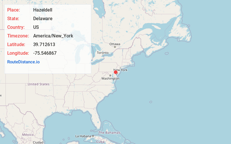
Full AddressHazeldell, DE 19720
-
Coordinates39.7126132, -75.5468671
-
LocationDelaware , US
-
TimezoneAmerica/New_York
-
Current Local Time12:51:58 PM America/New_YorkSunday, June 15, 2025
-
Page Views0
Nearby Places
Found 10 places within 50 miles

Rosegate
0.2 mi
0.3 km
Rosegate, DE 19720
Get directions
Millside
0.5 mi
0.8 km
Millside, DE 19801
Get directions
Simonds Gardens
0.5 mi
0.8 km
Simonds Gardens, DE 19720
Get directions
Dunleith
0.5 mi
0.8 km
Dunleith, DE 19801
Get directions
Holloway Terrace
0.7 mi
1.1 km
Holloway Terrace, DE 19720
Get directions
Garfield Park
0.9 mi
1.4 km
Garfield Park, DE 19720
Get directions
Swanwyck
1.5 mi
2.4 km
Swanwyck, DE 19720
Get directions
Landers Park
1.7 mi
2.7 km
Landers Park, DE 19720
Get directions
Alban Park
1.9 mi
3.1 km
Alban Park, DE 19805
Get directions
Latimer Estates
2.0 mi
3.2 km
Latimer Estates, DE 19805
Get directions
Location Links
Local Weather
Weather Information
Coming soon!
Location Map
Static map view of Hazeldell, Delaware
Browse Places by Distance
Places within specific distances from Hazeldell
Short Distances
Long Distances
Click any distance to see all places within that range from Hazeldell. Distances shown in miles (1 mile ≈ 1.61 kilometers).