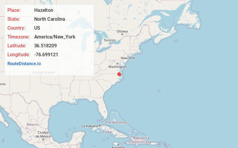
Distance to Hazelton, North Carolina

Calculating Your Route
Just a moment while we process your request...
Location Information
-
Full AddressHazelton, NC 27937
-
Coordinates36.5182087, -76.6991214
-
LocationNorth Carolina , US
-
TimezoneAmerica/New_York
-
Current Local Time5:10:59 PM America/New_YorkTuesday, June 17, 2025
-
Page Views0
Nearby Places
Found 10 places within 50 miles

Buckland
4.6 mi
7.4 km
Buckland, NC 27937
Get directions
Savage
6.4 mi
10.3 km
Savage, NC 27979
Get directions
Eleanors Crossroads
6.5 mi
10.5 km
Eleanors Crossroads, NC 27937
Get directions
Kellogs Fork
6.8 mi
10.9 km
Kellogs Fork, Sunbury, NC 27979
Get directions
Sunbury
7.2 mi
11.6 km
Sunbury, NC 27979
Get directions
Roduco
7.3 mi
11.7 km
Roduco, NC
Get directions

Gatesville
8.5 mi
13.7 km
Gatesville, NC 27938
Get directions
Cleopus
8.9 mi
14.3 km
Cleopus, Suffolk, VA 23437
Get directions
Dort
9.5 mi
15.3 km
Dort, NC 27937
Get directions
Topsy
9.6 mi
15.4 km
Topsy, NC 27937
Get directions
Location Links
Local Weather
Weather Information
Coming soon!
Location Map
Static map view of Hazelton, North Carolina
Browse Places by Distance
Places within specific distances from Hazelton
Short Distances
Long Distances
Click any distance to see all places within that range from Hazelton. Distances shown in miles (1 mile ≈ 1.61 kilometers).