Distance to Howcott, Louisiana

Calculating Your Route
Just a moment while we process your request...
Location Information
-
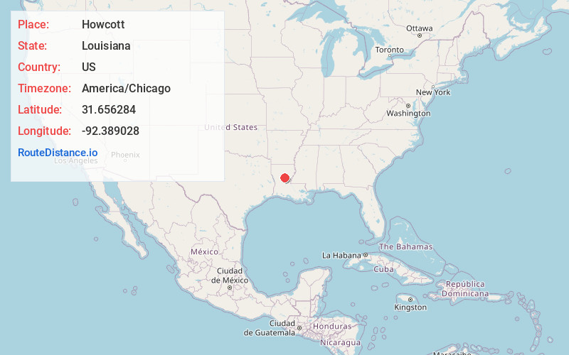
Full AddressHowcott, LA 71467
-
Coordinates31.6562837, -92.3890277
-
LocationLouisiana , US
-
TimezoneAmerica/Chicago
-
Current Local Time12:40:25 PM America/ChicagoMonday, June 30, 2025
-
Page Views0
Nearby Places
Found 10 places within 50 miles

Camp Hardtner
1.8 mi
2.9 km
Camp Hardtner, LA 71467
Get directions
Selma
5.9 mi
9.5 km
Selma, LA 71432
Get directions
Zenoria
6.9 mi
11.1 km
Zenoria, LA 71371
Get directions
Little Creek
7.1 mi
11.4 km
Little Creek, LA 71371
Get directions

Georgetown
7.2 mi
11.6 km
Georgetown, LA 71432
Get directions
Ganeyville
7.7 mi
12.4 km
Ganeyville, LA 71371
Get directions
White Sulphur Springs
7.8 mi
12.6 km
White Sulphur Springs, LA 71371
Get directions
Grandstaff
8.3 mi
13.4 km
Grandstaff, LA 71432
Get directions

Pollock
9.1 mi
14.6 km
Pollock, LA
Get directions
Rochelle
9.3 mi
15.0 km
Rochelle, LA 71432
Get directions
Location Links
Local Weather
Weather Information
Coming soon!
Location Map
Static map view of Howcott, Louisiana
Browse Places by Distance
Places within specific distances from Howcott
Short Distances
Long Distances
Click any distance to see all places within that range from Howcott. Distances shown in miles (1 mile ≈ 1.61 kilometers).