Distance to Johnsons Mill, Alabama

Calculating Your Route
Just a moment while we process your request...
Location Information
-
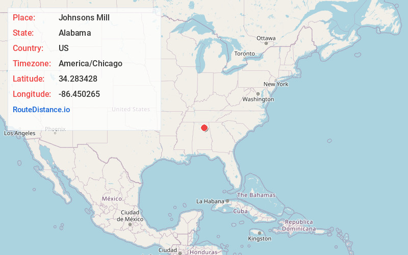
Full AddressJohnsons Mill, AL 35016
-
Coordinates34.2834277, -86.4502647
-
LocationAlabama , US
-
TimezoneAmerica/Chicago
-
Current Local Time2:35:22 AM America/ChicagoMonday, June 23, 2025
-
Page Views0
Nearby Places
Found 10 places within 50 miles

Askea Grove
0.5 mi
0.8 km
Askea Grove, AL 35016
Get directions
Thrasher Crossroads
1.8 mi
2.9 km
Thrasher Crossroads, AL 35016
Get directions
Hopewell
2.1 mi
3.4 km
Hopewell, AL 35016
Get directions
Diamond
3.3 mi
5.3 km
Diamond, AL 35976
Get directions

Arab
3.5 mi
5.6 km
Arab, AL 35016
Get directions
Sunset Acres
4.4 mi
7.1 km
Sunset Acres, Arab, AL 35016
Get directions
Sidney
4.8 mi
7.7 km
Sidney, AL 35976
Get directions
New Harmony
5.5 mi
8.9 km
New Harmony, AL 35016
Get directions

Joppa
6.2 mi
10.0 km
Joppa, AL
Get directions
Nixon Chapel
6.6 mi
10.6 km
Nixon Chapel, AL 35980
Get directions
Location Links
Local Weather
Weather Information
Coming soon!
Location Map
Static map view of Johnsons Mill, Alabama
Browse Places by Distance
Places within specific distances from Johnsons Mill
Short Distances
Long Distances
Click any distance to see all places within that range from Johnsons Mill. Distances shown in miles (1 mile ≈ 1.61 kilometers).