Distance to L S Park, Kentucky

Calculating Your Route
Just a moment while we process your request...
Location Information
-
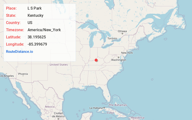
Full AddressL S Park, KY 40067
-
Coordinates38.1956245, -85.3996792
-
LocationKentucky , US
-
TimezoneAmerica/New_York
-
Current Local Time6:19:28 PM America/New_YorkFriday, June 27, 2025
-
Page Views0
Nearby Places
Found 10 places within 50 miles

Conner
2.0 mi
3.2 km
Conner, KY 40067
Get directions
Lincoln Ridge
2.1 mi
3.4 km
Lincoln Ridge, KY 40067
Get directions

Simpsonville
3.5 mi
5.6 km
Simpsonville, KY 40067
Get directions
Wilsonville
4.7 mi
7.6 km
Wilsonville, KY 40023
Get directions
Finchville
5.5 mi
8.9 km
Finchville, KY 40022
Get directions
Joyes
6.0 mi
9.7 km
Joyes, KY 40065
Get directions
Veech
6.7 mi
10.8 km
Veech, KY 40065
Get directions
Todds Point
6.8 mi
10.9 km
Todds Point, KY 40067
Get directions
Normandy
7.4 mi
11.9 km
Normandy, KY 40071
Get directions
Woodland Hills
7.6 mi
12.2 km
Woodland Hills, KY 40243
Get directions
Location Links
Local Weather
Weather Information
Coming soon!
Location Map
Static map view of L S Park, Kentucky
Browse Places by Distance
Places within specific distances from L S Park
Short Distances
Long Distances
Click any distance to see all places within that range from L S Park. Distances shown in miles (1 mile ≈ 1.61 kilometers).