Distance to Mooresville, Kentucky

Calculating Your Route
Just a moment while we process your request...
Location Information
-
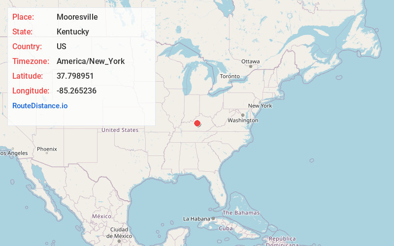
Full AddressMooresville, KY 40069
-
Coordinates37.7989507, -85.2652361
-
LocationKentucky , US
-
TimezoneAmerica/New_York
-
Current Local Time9:43:54 PM America/New_YorkWednesday, June 25, 2025
-
Page Views0
About Mooresville
Mooresville is an unincorporated community located in Washington County, Kentucky, United States. Its post office is closed.
Nearby Places
Found 10 places within 50 miles

Maud
2.3 mi
3.7 km
Maud, KY 40069
Get directions
Valley Hill
3.3 mi
5.3 km
Valley Hill, KY 40069
Get directions
Croakes
4.0 mi
6.4 km
Croakes, KY 40069
Get directions
Litsey
4.5 mi
7.2 km
Litsey, KY 40069
Get directions
Bearwallow
7.2 mi
11.6 km
Bearwallow, KY 40069
Get directions
Briartown
7.4 mi
11.9 km
Briartown, Springfield, KY 40069
Get directions
Willisburg
7.7 mi
12.4 km
Willisburg, KY 40078
Get directions

Springfield
8.1 mi
13.0 km
Springfield, KY
Get directions
Cartwright Creek
8.2 mi
13.2 km
Cartwright Creek, Kentucky
Get directions

Bloomfield
8.3 mi
13.4 km
Bloomfield, KY 40008
Get directions
Location Links
Local Weather
Weather Information
Coming soon!
Location Map
Static map view of Mooresville, Kentucky
Browse Places by Distance
Places within specific distances from Mooresville
Short Distances
Long Distances
Click any distance to see all places within that range from Mooresville. Distances shown in miles (1 mile ≈ 1.61 kilometers).