Distance to Nelson, Arizona

Calculating Your Route
Just a moment while we process your request...
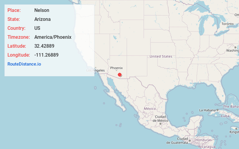
Location Information
-
Full AddressNelson, AZ 85653
-
Coordinates32.42889, -111.26889
-
LocationNelson , Arizona , US
-
TimezoneAmerica/Phoenix
-
Current Local Time10:27:20 PM America/PhoenixThursday, June 19, 2025
-
Page Views0
About Nelson
Nelson is a census-designated place in Pima County, Arizona, United States. The population was 259 at the 2010 census.
Nearby Places
Found 10 places within 50 miles

Marana
2.8 mi
4.5 km
Marana, AZ
Get directions

Avra Valley
2.8 mi
4.5 km
Avra Valley, AZ 85653
Get directions

Picture Rocks
5.9 mi
9.5 km
Picture Rocks, AZ
Get directions

Red Rock
10.6 mi
17.1 km
Red Rock, AZ
Get directions

Tucson Mountains
16.7 mi
26.9 km
Tucson Mountains, Arizona 85745
Get directions

Casas Adobes
17.6 mi
28.3 km
Casas Adobes, AZ
Get directions

Flowing Wells
17.6 mi
28.3 km
Flowing Wells, AZ
Get directions

Oro Valley
17.8 mi
28.6 km
Oro Valley, AZ
Get directions

Tucson Estates
19.6 mi
31.5 km
Tucson Estates, AZ
Get directions

Catalina
20.9 mi
33.6 km
Catalina, AZ 85739
Get directions
Location Links
Local Weather
Weather Information
Coming soon!
Location Map
Static map view of Nelson, Arizona
Browse Places by Distance
Places within specific distances from Nelson
Short Distances
Long Distances
Click any distance to see all places within that range from Nelson. Distances shown in miles (1 mile ≈ 1.61 kilometers).