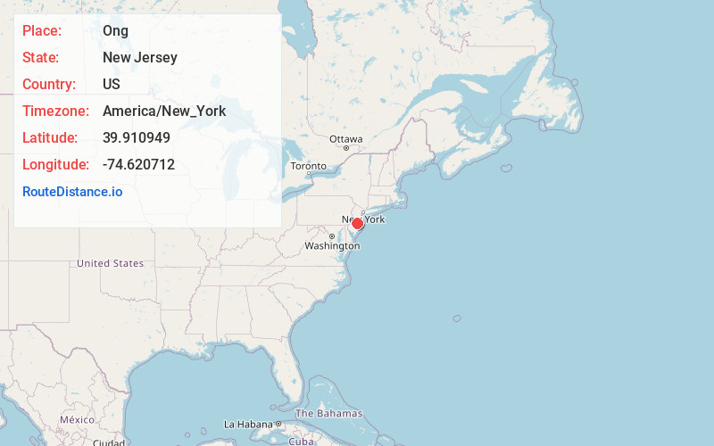
Distance to and from Ong, New Jersey
Ong, Southampton Township, NJ 08088
Southampton Township
New Jersey
US
America/New_York
Location Information
-
Full AddressOng, Southampton Township, NJ 08088
-
Coordinates39.9109486, -74.6207117
-
LocationSouthampton Township , New Jersey , US
-
TimezoneAmerica/New_York
-
Current Local Time7:05:42 PM America/New_YorkSaturday, May 3, 2025
-
Page Views0
Directions to Nearest Cities
Burrs Mill
Burrs Mill, Southampton Township, NJ 08088
2.2 mi
Johnson Place
Johnson Place, Woodland, NJ 08088
3.3 mi
Scrapetown
Scrapetown, Pemberton Township, NJ 08068
4.6 mi
Pemberton
Pemberton, NJ 08068
5.4 mi
Upton
Upton, Pemberton Township, NJ 08015
5.4 mi
Crescent Heights
Crescent Heights, Southampton Township, NJ 08088
6.5 mi
About Ong
Ong's Hat is a ghost town in Pemberton Township, Burlington County, in the U.S. state of New Jersey. It is located on Magnolia Road west of the Four Mile Circle, where New Jersey Route 72 intersects with New Jersey Route 70. It is the northern terminus of the Batona Trail.
Nearby Places
Found 10 places within 50 miles

Burrs Mill
2.2 mi
3.5 km
Burrs Mill, Southampton Township, NJ 08088
Get directions
Johnson Place
3.3 mi
5.3 km
Johnson Place, Woodland, NJ 08088
Get directions
Scrapetown
4.6 mi
7.4 km
Scrapetown, Pemberton Township, NJ 08068
Get directions

Pemberton
5.4 mi
8.7 km
Pemberton, NJ 08068
Get directions
Upton
5.4 mi
8.7 km
Upton, Pemberton Township, NJ 08015
Get directions
Crescent Heights
6.5 mi
10.5 km
Crescent Heights, Southampton Township, NJ 08088
Get directions
Moores Mill
6.5 mi
10.5 km
Moores Mill, Tabernacle, NJ 08088
Get directions

Southampton Township
6.6 mi
10.6 km
Southampton Township, NJ 08088
Get directions
Oak Shade
6.6 mi
10.6 km
Oak Shade, Southampton Township, NJ 08088
Get directions
Bozuretown
6.9 mi
11.1 km
Bozuretown, Tabernacle, NJ 08088
Get directions
Burrs Mill
2.2 mi
3.5 km
Burrs Mill, Southampton Township, NJ 08088
Johnson Place
3.3 mi
5.3 km
Johnson Place, Woodland, NJ 08088
Scrapetown
4.6 mi
7.4 km
Scrapetown, Pemberton Township, NJ 08068
Pemberton
5.4 mi
8.7 km
Pemberton, NJ 08068
Upton
5.4 mi
8.7 km
Upton, Pemberton Township, NJ 08015
Crescent Heights
6.5 mi
10.5 km
Crescent Heights, Southampton Township, NJ 08088
Moores Mill
6.5 mi
10.5 km
Moores Mill, Tabernacle, NJ 08088
Southampton Township
6.6 mi
10.6 km
Southampton Township, NJ 08088
Oak Shade
6.6 mi
10.6 km
Oak Shade, Southampton Township, NJ 08088
Bozuretown
6.9 mi
11.1 km
Bozuretown, Tabernacle, NJ 08088
Location Links
Local Weather
Weather Information
Coming soon!
Location Map
Static map view of Ong, New Jersey
Browse Places by Distance
Places within specific distances from Ong
Short Distances
Long Distances
Click any distance to see all places within that range from Ong. Distances shown in miles (1 mile ≈ 1.61 kilometers).