Distance to Persia, Tennessee

Calculating Your Route
Just a moment while we process your request...
Location Information
-
Full AddressPersia, TN 37857
-
Coordinates36.3398184, -83.0029404
-
LocationTennessee , US
-
TimezoneAmerica/New_York
-
Current Local Time5:21:42 AM America/New_YorkWednesday, June 18, 2025
-
Page Views0
About Persia
Persia is an unincorporated community in Hawkins County, Tennessee, south of Rogersville.
Persia is located on Tennessee State Routes 66 and 70.


Nearby Places
Found 10 places within 50 miles

Grigsby
1.2 mi
1.9 km
Grigsby, TN 37857
Get directions
Austins Mill
2.3 mi
3.7 km
Austins Mill, TN 37857
Get directions
Otes
2.4 mi
3.9 km
Otes, TN 37711
Get directions
Strahl
2.8 mi
4.5 km
Strahl, TN 37857
Get directions
Henardtown
3.1 mi
5.0 km
Henardtown, TN 37857
Get directions
McDonald Hill
3.8 mi
6.1 km
McDonald Hill, TN 37857
Get directions
Guntown
3.9 mi
6.3 km
Guntown, TN 37857
Get directions

Rogersville
4.7 mi
7.6 km
Rogersville, TN 37857
Get directions

St Clair
4.7 mi
7.6 km
St Clair, TN 37711
Get directions
White Horn
4.8 mi
7.7 km
White Horn, TN 37711
Get directions
Location Links
Local Weather
Weather Information
Coming soon!
Location Map
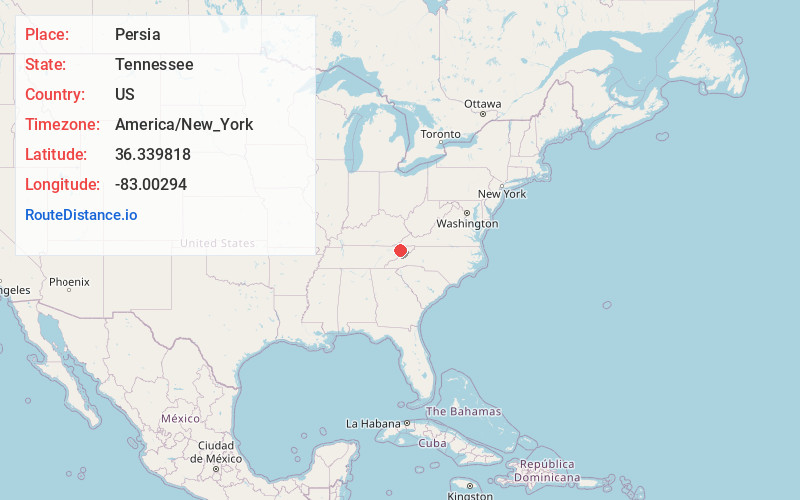
Static map view of Persia, Tennessee
Browse Places by Distance
Places within specific distances from Persia
Short Distances
Long Distances
Click any distance to see all places within that range from Persia. Distances shown in miles (1 mile ≈ 1.61 kilometers).