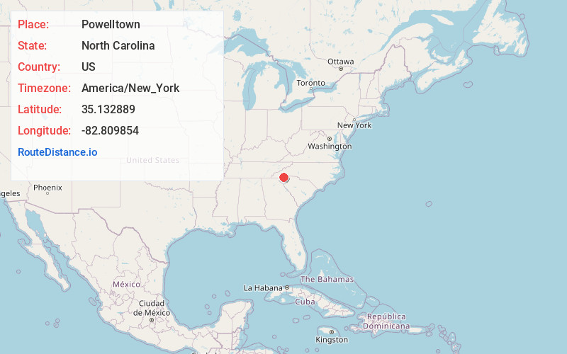
Distance to Powelltown, North Carolina

Calculating Your Route
Just a moment while we process your request...
Location Information
-
Full AddressPowelltown, NC 28772
-
Coordinates35.1328887, -82.8098542
-
LocationNorth Carolina , US
-
TimezoneAmerica/New_York
-
Current Local Time1:18:06 AM America/New_YorkFriday, June 20, 2025
-
Page Views0
Nearby Places
Found 10 places within 50 miles

Rosman
1.0 mi
1.6 km
Rosman, NC
Get directions

Piney Woods
2.0 mi
3.2 km
Piney Woods, NC 28712
Get directions
Happy Acres
5.9 mi
9.5 km
Happy Acres, NC 28712
Get directions
Seeshore
6.2 mi
10.0 km
Seeshore, NC 28712
Get directions

Brevard
8.2 mi
13.2 km
Brevard, NC
Get directions
Blantyre
15.5 mi
24.9 km
Blantyre, NC 28768
Get directions

Cashiers
16.4 mi
26.4 km
Cashiers, NC 28717
Get directions

Etowah
17.6 mi
28.3 km
Etowah, NC
Get directions

Glenville
18.1 mi
29.1 km
Glenville, NC 28736
Get directions

Pickens
18.2 mi
29.3 km
Pickens, SC 29671
Get directions
Location Links
Local Weather
Weather Information
Coming soon!
Location Map
Static map view of Powelltown, North Carolina
Browse Places by Distance
Places within specific distances from Powelltown
Short Distances
Long Distances
Click any distance to see all places within that range from Powelltown. Distances shown in miles (1 mile ≈ 1.61 kilometers).