Distance to Rockland, Kentucky

Calculating Your Route
Just a moment while we process your request...
Location Information
-
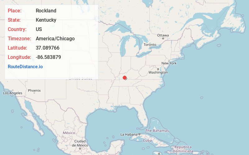
Full AddressRockland, KY 42101
-
Coordinates37.0897662, -86.5838789
-
LocationKentucky , US
-
TimezoneAmerica/Chicago
-
Current Local Time12:22:10 PM America/ChicagoMonday, June 23, 2025
-
Page Views0
Nearby Places
Found 10 places within 50 miles

Woodbury
7.0 mi
11.3 km
Woodbury, KY 42261
Get directions

Dimple
7.6 mi
12.2 km
Dimple, KY 42261
Get directions
Browning
10.0 mi
16.1 km
Browning, KY 42274
Get directions

Bowling Green
10.1 mi
16.3 km
Bowling Green, KY
Get directions

Morgantown
10.9 mi
17.5 km
Morgantown, KY 42261
Get directions
Plum Springs
12.2 mi
19.6 km
Plum Springs, KY 42101
Get directions
Roundhill
13.2 mi
21.2 km
Roundhill, KY 42275
Get directions
Bristow
13.3 mi
21.4 km
Bristow, KY 42103
Get directions
Sunnyside
15.8 mi
25.4 km
Sunnyside, KY 42101
Get directions
Dexterville
16.2 mi
26.1 km
Dexterville, KY 42261
Get directions
Location Links
Local Weather
Weather Information
Coming soon!
Location Map
Static map view of Rockland, Kentucky
Browse Places by Distance
Places within specific distances from Rockland
Short Distances
Long Distances
Click any distance to see all places within that range from Rockland. Distances shown in miles (1 mile ≈ 1.61 kilometers).