Distance to Salem, New Jersey

Calculating Your Route
Just a moment while we process your request...
Location Information
-
Full AddressSalem, NJ
-
Coordinates39.5719002, -75.4670372
-
LocationSalem , New Jersey , US
-
TimezoneAmerica/New_York
-
Current Local Time8:35:57 PM America/New_YorkTuesday, June 17, 2025
-
Page Views0
About Salem
Salem is a city in and the county seat of Salem County, the most rural county in the U.S. state of New Jersey. The name Salem, for both the city and county, is derived from the Hebrew word shalom, meaning peace.


Nearby Places
Found 10 places within 50 miles

Pennsville Township
6.4 mi
10.3 km
Pennsville Township, NJ
Get directions

New Castle
8.2 mi
13.2 km
New Castle, DE 19720
Get directions

Carneys Point Township
9.3 mi
15.0 km
Carneys Point Township, NJ
Get directions

Wilmington Manor
10.1 mi
16.3 km
Wilmington Manor, DE 19720
Get directions

Bear
10.9 mi
17.5 km
Bear, DE
Get directions

Edgemoor
12.4 mi
20.0 km
Edgemoor, DE
Get directions

Wilmington
12.7 mi
20.4 km
Wilmington, DE
Get directions

Upper Deerfield Township
12.8 mi
20.6 km
Upper Deerfield Township, NJ
Get directions
Elsmere
13.5 mi
21.7 km
Elsmere, DE
Get directions

Woolwich Township
13.7 mi
22.0 km
Woolwich Township, NJ
Get directions
Location Links
Local Weather
Weather Information
Coming soon!
Location Map
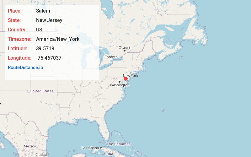
Static map view of Salem, New Jersey
Browse Places by Distance
Places within specific distances from Salem
Short Distances
Long Distances
Click any distance to see all places within that range from Salem. Distances shown in miles (1 mile ≈ 1.61 kilometers).