Distance to Samoa, California

Calculating Your Route
Just a moment while we process your request...
Location Information
-
Full AddressSamoa, CA
-
Coordinates40.8126107, -124.1906913
-
LocationSamoa , California , US
-
TimezoneAmerica/Los_Angeles
-
Current Local Time10:22:49 PM America/Los_AngelesThursday, June 19, 2025
-
Page Views0
About Samoa
Samoa is a census-designated place in Humboldt County, California. It is located 1.5 miles northwest of Eureka, at an elevation of 23 feet. Samoa is located in the northern peninsula of Humboldt Bay and is the site of the Samoa Cookhouse, one of the last remaining original lumber camp–style cookhouses.


Nearby Places
Found 10 places within 50 miles

Eureka
1.6 mi
2.6 km
Eureka, CA
Get directions

Fairhaven
1.8 mi
2.9 km
Fairhaven, CA 95564
Get directions

Manila
3.1 mi
5.0 km
Manila, CA 95521
Get directions

Myrtletown
3.6 mi
5.8 km
Myrtletown, CA
Get directions
Cutten
3.9 mi
6.3 km
Cutten, CA 95503
Get directions

Humboldt Hill
6.0 mi
9.7 km
Humboldt Hill, CA 95503
Get directions

Fields Landing
6.2 mi
10.0 km
Fields Landing, CA
Get directions

Arcata
6.8 mi
10.9 km
Arcata, CA
Get directions

McKinleyville
10.4 mi
16.7 km
McKinleyville, CA 95519
Get directions

Blue Lake
11.8 mi
19.0 km
Blue Lake, CA
Get directions
Location Links
Local Weather
Weather Information
Coming soon!
Location Map
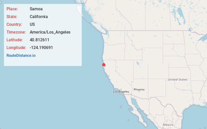
Static map view of Samoa, California
Browse Places by Distance
Places within specific distances from Samoa
Short Distances
Long Distances
Click any distance to see all places within that range from Samoa. Distances shown in miles (1 mile ≈ 1.61 kilometers).