Distance to Sand, Texas

Calculating Your Route
Just a moment while we process your request...
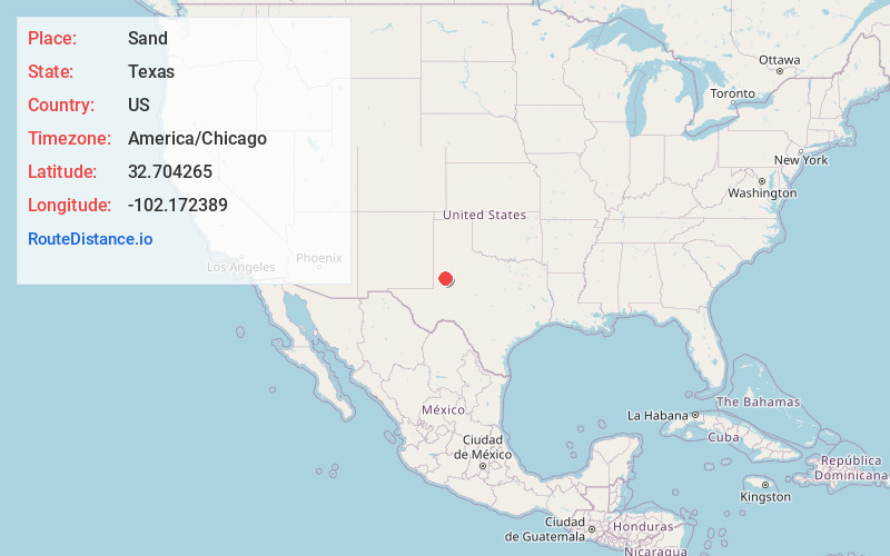
Location Information
-
Full AddressSand, TX 79331
-
Coordinates32.7042648, -102.1723893
-
LocationTexas , US
-
TimezoneAmerica/Chicago
-
Current Local Time1:58:29 PM America/ChicagoWednesday, May 28, 2025
-
Page Views0
Nearby Places
Found 10 places within 50 miles

Lamesa
13.1 mi
21.1 km
Lamesa, TX 79331
Get directions

Los Ybanez
14.9 mi
24.0 km
Los Ybanez, TX 79331
Get directions

Welch
15.8 mi
25.4 km
Welch, TX 79377
Get directions

Loop
20.3 mi
32.7 km
Loop, TX 79342
Get directions

O'Donnell
26.7 mi
43.0 km
O'Donnell, TX 79351
Get directions

Seminole
27.5 mi
44.3 km
Seminole, TX 79360
Get directions

Wellman
28.0 mi
45.1 km
Wellman, TX
Get directions

Seagraves
28.2 mi
45.4 km
Seagraves, TX 79359
Get directions

Ackerly
29.3 mi
47.2 km
Ackerly, TX 79713
Get directions

Tarzan
29.9 mi
48.1 km
Tarzan, TX 79783
Get directions
Location Links
Local Weather
Weather Information
Coming soon!
Location Map
Static map view of Sand, Texas
Browse Places by Distance
Places within specific distances from Sand
Short Distances
Long Distances
Click any distance to see all places within that range from Sand. Distances shown in miles (1 mile ≈ 1.61 kilometers).