Distance to Shawnee, Kansas

Calculating Your Route
Just a moment while we process your request...
Location Information
-
Full AddressShawnee, KS
-
Coordinates39.0228485, -94.7151865
-
LocationShawnee , Kansas , US
-
TimezoneAmerica/Chicago
-
Current Local Time4:05:02 PM America/ChicagoWednesday, June 18, 2025
-
Website
-
Page Views0
About Shawnee
Shawnee is a city in Johnson County, Kansas, United States. It is the seventh-most populous municipality in the Kansas City metropolitan area. As of the 2020 census, the population of the city was 67,311.


Nearby Places
Found 7 places within 50 miles

Overland Park
3.7 mi
6.0 km
Overland Park, KS
Get directions

Kansas City
8.0 mi
12.9 km
Kansas City, KS
Get directions

Kansas City
9.1 mi
14.6 km
Kansas City, MO
Get directions

Olathe
11.3 mi
18.2 km
Olathe, KS
Get directions

Independence
16.8 mi
27.0 km
Independence, MO
Get directions

Lee's Summit
19.5 mi
31.4 km
Lee's Summit, MO
Get directions

Lawrence
28.2 mi
45.4 km
Lawrence, KS
Get directions
Location Links
Local Weather
Weather Information
Coming soon!
Location Map
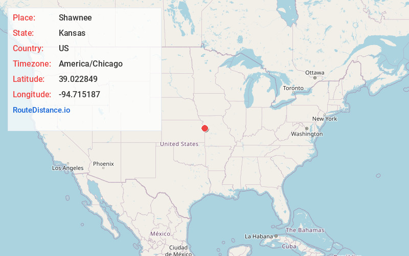
Static map view of Shawnee, Kansas
Browse Places by Distance
Places within specific distances from Shawnee
Short Distances
Long Distances
Click any distance to see all places within that range from Shawnee. Distances shown in miles (1 mile ≈ 1.61 kilometers).