Distance to Sheridan, Oregon

Calculating Your Route
Just a moment while we process your request...
Location Information
-
Full AddressSheridan, OR 97378
-
Coordinates45.0972788, -123.3953926
-
LocationSheridan , Oregon , US
-
TimezoneAmerica/Los_Angeles
-
Current Local Time7:29:37 PM America/Los_AngelesWednesday, June 18, 2025
-
Website
-
Page Views0
About Sheridan
Sheridan is a city in Yamhill County, Oregon, United States. Platted in the 1860s when it received a post office, Sheridan was incorporated in 1880. In 1913, much of the town burned in a fire and a flood covered much of the community in 1964.


Nearby Places
Found 10 places within 50 miles

McMinnville
12.5 mi
20.1 km
McMinnville, OR 97128
Get directions

Dallas
12.9 mi
20.8 km
Dallas, OR 97338
Get directions

Monmouth
18.9 mi
30.4 km
Monmouth, OR
Get directions

Keizer
19.5 mi
31.4 km
Keizer, OR
Get directions

Independence
19.8 mi
31.9 km
Independence, OR
Get directions

Salem
20.6 mi
33.2 km
Salem, OR
Get directions

Hayesville
22.1 mi
35.6 km
Hayesville, OR 97305
Get directions

Four Corners
23.3 mi
37.5 km
Four Corners, OR
Get directions

Newberg
24.8 mi
39.9 km
Newberg, OR 97132
Get directions

Woodburn
26.5 mi
42.6 km
Woodburn, OR
Get directions
Location Links
Local Weather
Weather Information
Coming soon!
Location Map
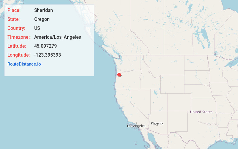
Static map view of Sheridan, Oregon
Browse Places by Distance
Places within specific distances from Sheridan
Short Distances
Long Distances
Click any distance to see all places within that range from Sheridan. Distances shown in miles (1 mile ≈ 1.61 kilometers).