Distance to Stella, Arkansas

Calculating Your Route
Just a moment while we process your request...
Location Information
-
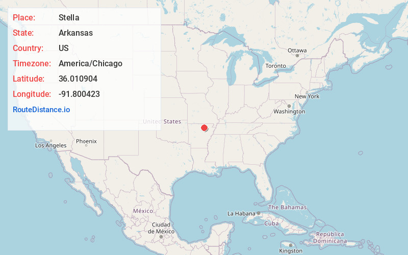
Full AddressStella, Mt Pleasant, AR 72556
-
Coordinates36.0109044, -91.8004234
-
LocationMt Pleasant , Arkansas , US
-
TimezoneAmerica/Chicago
-
Current Local Time7:43:26 AM America/ChicagoSunday, June 1, 2025
-
Page Views0
Nearby Places
Found 10 places within 50 miles

Gid
3.8 mi
6.1 km
Gid, AR 72540
Get directions

Mt Pleasant
4.2 mi
6.8 km
Mt Pleasant, AR
Get directions
Lacrosse
6.0 mi
9.7 km
Lacrosse, AR 72584
Get directions
Lunenburg
6.0 mi
9.7 km
Lunenburg, AR 72540
Get directions
Lafferty
6.8 mi
10.9 km
Lafferty, AR 72501
Get directions

Melbourne
6.8 mi
10.9 km
Melbourne, AR 72556
Get directions
Sidney
7.9 mi
12.7 km
Sidney, AR
Get directions
Larkin
7.9 mi
12.7 km
Larkin, AR 72584
Get directions
Belview
8.6 mi
13.8 km
Belview, AR 72556
Get directions

Guion
9.8 mi
15.8 km
Guion, AR
Get directions
Location Links
Local Weather
Weather Information
Coming soon!
Location Map
Static map view of Stella, Arkansas
Browse Places by Distance
Places within specific distances from Stella
Short Distances
Long Distances
Click any distance to see all places within that range from Stella. Distances shown in miles (1 mile ≈ 1.61 kilometers).