Distance to Tie Siding, Wyoming

Calculating Your Route
Just a moment while we process your request...
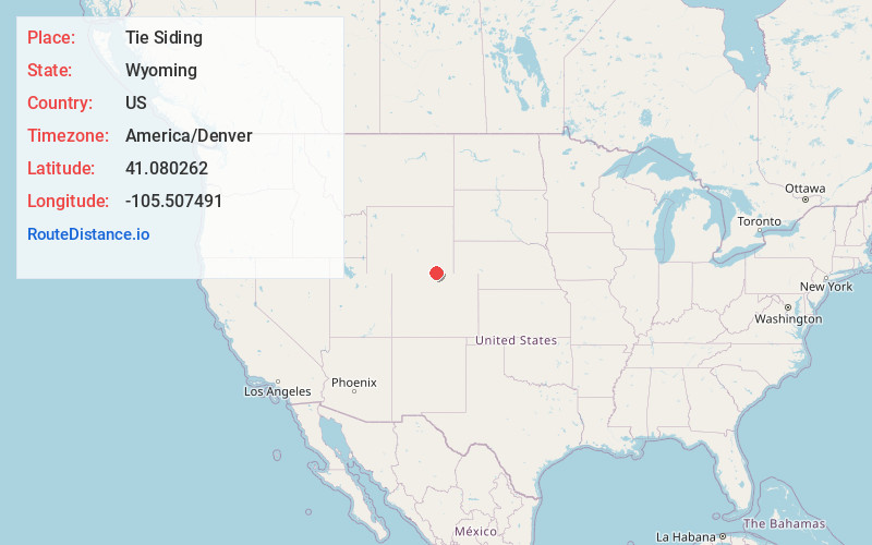
Location Information
-
Full AddressTie Siding, WY 82084
-
Coordinates41.0802621, -105.5074905
-
LocationTie Siding , Wyoming , US
-
TimezoneAmerica/Denver
-
Current Local Time3:49:47 AM America/DenverThursday, June 19, 2025
-
Page Views0
About Tie Siding
Tie Siding is a tiny unincorporated community in far southeastern Albany County, in southeastern Wyoming, United States, approximately eighteen miles south of Laramie, and eight miles north of the Colorado border. It is located at latitude 41.080N and longitude -105.506W, at an elevation of 7,694 ft.


Nearby Places
Found 10 places within 50 miles

Sherman
8.2 mi
13.2 km
Sherman, WY 82052
Get directions

Laramie
16.5 mi
26.6 km
Laramie, WY
Get directions

Red Feather Lakes
19.7 mi
31.7 km
Red Feather Lakes, CO 80545
Get directions

Woods Landing-Jelm
25.8 mi
41.5 km
Woods Landing-Jelm, WY
Get directions
Eggers
26.9 mi
43.3 km
Eggers, CO 80536
Get directions
Glendevey
29.1 mi
46.8 km
Glendevey, CO 82063
Get directions
Warren
33.1 mi
53.3 km
Warren, CO 80612
Get directions

Albany
33.3 mi
53.6 km
Albany, WY 82070
Get directions
Foxpark
33.6 mi
54.1 km
Foxpark, WY 82070
Get directions

Cheyenne
35.9 mi
57.8 km
Cheyenne, WY
Get directions
Location Links
Local Weather
Weather Information
Coming soon!
Location Map
Static map view of Tie Siding, Wyoming
Browse Places by Distance
Places within specific distances from Tie Siding
Short Distances
Long Distances
Click any distance to see all places within that range from Tie Siding. Distances shown in miles (1 mile ≈ 1.61 kilometers).