Distance to Uzès, Occitanie

Calculating Your Route
Just a moment while we process your request...
Location Information
-
Full Address30700 Uzès, France
-
Coordinates44.01211, 4.419946
-
LocationUzès , Occitanie , FR
-
TimezoneEurope/Paris
-
Current Local Time12:22:59 AM Europe/ParisThursday, June 5, 2025
-
Website
-
Page Views0
About Uzès
Uzès is a commune in the Gard department in the Occitanie region of Southern France. Uzès lies about 25 kilometres north-northeast of Nîmes, 40 kilometres west of Avignon, and 32 kilometres southeast of Alès.


Nearby Places
Found 6 places within 50 miles

Avignon
19.7 mi
31.7 km
Avignon, France
Get directions

Arles
25.4 mi
40.9 km
Arles, France
Get directions

Castries
31.7 mi
51.0 km
34160 Castries, France
Get directions

Montpellier
38.8 mi
62.4 km
Montpellier, France
Get directions
Lacoste
44.2 mi
71.1 km
84480 Lacoste, France
Get directions

Lourmarin
50.0 mi
80.5 km
84160 Lourmarin, France
Get directions
Location Links
Local Weather
Weather Information
Coming soon!
Location Map
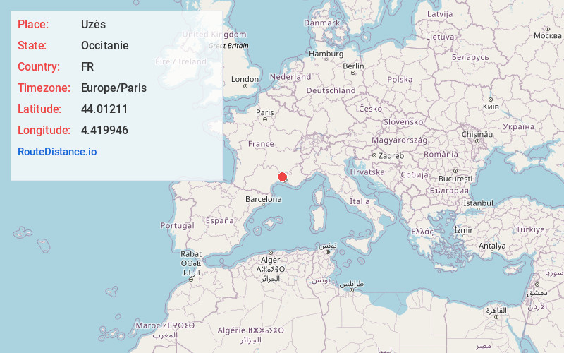
Static map view of Uzès, Occitanie
Browse Places by Distance
Places within specific distances from Uzès
Short Distances
Long Distances
Click any distance to see all places within that range from Uzès. Distances shown in miles (1 mile ≈ 1.61 kilometers).