Distance to Whitehouse, Kentucky

Calculating Your Route
Just a moment while we process your request...
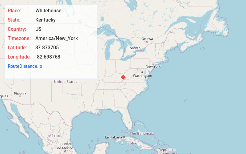
Location Information
-
Full AddressWhitehouse, KY 41240
-
Coordinates37.8737047, -82.6987684
-
LocationWhitehouse , Kentucky , US
-
TimezoneAmerica/New_York
-
Current Local Time10:02:04 AM America/New_YorkThursday, May 29, 2025
-
Page Views0
About Whitehouse
Whitehouse is an unincorporated community in Johnson County, Kentucky, United States. In its early years, it was called Mt. Carbon and housed families from two different coal companies, Sandy River Cannel Coal Company and Whitehouse Cannel Coal Company.
Nearby Places
Found 10 places within 50 miles

Chestnut
1.5 mi
2.4 km
Chestnut, KY 41240
Get directions
Lowmansville
3.5 mi
5.6 km
Lowmansville, KY 41232
Get directions
Williamsport
4.0 mi
6.4 km
Williamsport, KY 41271
Get directions
Tutor Key
4.2 mi
6.8 km
Tutor Key, KY 41263
Get directions
Patrick
4.6 mi
7.4 km
Patrick, KY 41230
Get directions

Ulysses
5.1 mi
8.2 km
Ulysses, KY 41264
Get directions
Peach Orchard
6.6 mi
10.6 km
Peach Orchard, KY 41230
Get directions

Paintsville
7.2 mi
11.6 km
Paintsville, KY
Get directions

Van Lear
7.8 mi
12.6 km
Van Lear, KY
Get directions

Inez
8.7 mi
14.0 km
Inez, KY 41224
Get directions
Location Links
Local Weather
Weather Information
Coming soon!
Location Map
Static map view of Whitehouse, Kentucky
Browse Places by Distance
Places within specific distances from Whitehouse
Short Distances
Long Distances
Click any distance to see all places within that range from Whitehouse. Distances shown in miles (1 mile ≈ 1.61 kilometers).