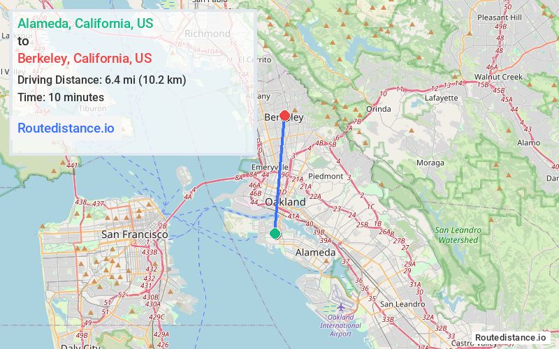
Distance from Alameda, California to Berkeley, California
The driving distance from Alameda, California to Berkeley, California is 10.2 mi (16.5 km)
The straight-line (air) distance is approximately 3.9 mi (6.4 km)
Estimated travel time by road is 18 minutes
We found 3 routes between Alameda and Berkeley.
Available Routes
Route Directions
Get on I-880 N in Oakland from Webster St and Posey Tube
Follow I-880 N, Exit 46B and I-580 W/I-80 E to University Ave in Berkeley. Take exit 11 from I-580 W/I-80 E
Route Directions
Get on I-880 N in Oakland from Webster St and Posey Tube
Take I-980 E and I-580 W/I-80 E to University Ave in Berkeley. Take exit 11 from I-580 W/I-80 E
Route Directions
Take Posey Tube, I-980 E and CA-24 E to Martin Luther King Jr Way in Berkeley
Journey Details
Traveling from Alameda, California to Berkeley, California covers 7.7 miles (12 km) in a north direction. This secondary roads, short route typically takes 17 minutes under normal conditions.
Drivers have 3 route options between these locations (8-10 miles / 12-16 km). The primary route shown here saves 2 minutes compared to alternatives.
The route features scenic views. During night weekend travel, expect typical weekend traffic patterns with average speeds around 29 mph (47 km/h) .
Journey Waypoints
Alameda
Starting Point
Berkeley
Destination
Route Map Image