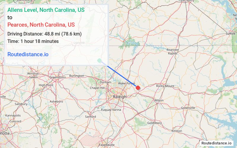
Distance from Allens Level, North Carolina to Pearces, North Carolina
The driving distance from Allens Level, North Carolina to Pearces, North Carolina is 61.5 mi (99 km)
The straight-line (air) distance is approximately 30.3 mi (48.8 km)
Estimated travel time by road is 1 hour 23 minutes
We found 3 routes between Allens Level and Pearces.
Available Routes
Route Directions
Take Cates Mill Rd to US-501 S
Continue on Quail Roost Rd. Take Stagville Rd, Red Mill Rd and Stallings Rd to NC-98 E
Continue on NC-98 E to Wake County
Continue on Halifax Rd. Take Pilot-Riley Rd to Pearces Rd in Franklin County
Route Directions
Follow Cates Mill Rd to US-501 S
Take Helena Moriah Rd and Enon Rd to Range Rd in Granville County
Continue on Range Rd to State Rte 1004/Old North Carolina 75
Take Brogden Rd to Hester Rd
Continue on NC-56 E. Take NC-39 S to Pearces Rd in Franklin County
Route Directions
Take Cates Mill Rd to US-501 S
Continue on Quail Roost Rd. Take Stagville Rd, Red Mill Rd and Stallings Rd to NC-98 E
Continue on NC-98 E to Wake County
Continue on Halifax Rd. Take Pilot-Riley Rd to Pearces Rd in Franklin County
Journey Details
Traveling from Allens Level, North Carolina to Pearces, North Carolina covers 61.2 miles (98 km) in a southeast direction. This mixed highways and local roads, substantial route typically takes 1 hour 23 minutes under normal conditions.
Drivers have 3 route options between these locations (61-63 miles / 98-102 km). The primary route shown here saves 20 seconds compared to alternatives.
The route features scenic views. During morning weekend travel, expect typical weekend traffic patterns with average speeds around 41 mph (66 km/h) .
Journey Waypoints
Allens Level
Starting Point
Pearces
Destination
Route Map Image