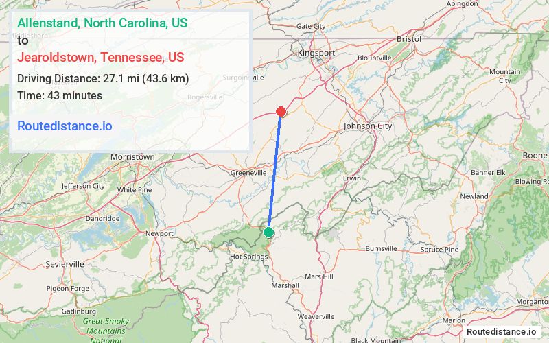
Distance from Allenstand, North Carolina to Jearoldstown, Tennessee
The driving distance from Allenstand, North Carolina to Jearoldstown, Tennessee is 40.9 mi (65.8 km)
The straight-line (air) distance is approximately 16.8 mi (27.1 km)
Estimated travel time by road is 51 minutes
We found 3 routes between Allenstand and Jearoldstown.
Available Routes
Route Directions
Drive from TN-70 N to Greeneville. Take the exit toward Airport/Baileyton from US-11E N
Get on I-81 N in Baileyton
Follow I-81 N to Jearoldstown Rd. Take exit 44 from I-81 N
Drive to Jearoldstown Rd in Chuckey
Route Directions
Take TN-70 N to TN-351 N in Greene County
Continue on TN-351 N. Take Shiloh Rd to Tusculum Bypass in Tusculum
Follow US-11E N/US-321 N, TN-351 N and TN-93 N to Smith Mill Rd Acc in Chuckey
Follow Smith Mill Rd to Jearoldstown Rd
Route Directions
Take TN-70 N and TN-93 N to Smith Mill Rd Acc in Chuckey
Follow Smith Mill Rd to Jearoldstown Rd
Journey Details
Traveling from Allenstand, North Carolina to Jearoldstown, Tennessee covers 37.3 miles (60 km) in a north direction. This mixed highways and local roads, moderate route typically takes 52 minutes under normal conditions.
Drivers have 3 route options between these locations (37-41 miles / 60-67 km). The primary route shown here saves 8 minutes compared to alternatives.
The route features scenic views. During evening weekend travel, expect typical weekend traffic patterns with average speeds around 43 mph (69 km/h) .
Journey Waypoints
Allenstand
Starting Point
Jearoldstown
Destination
Route Map Image