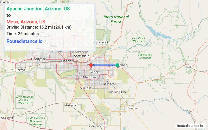
Distance from Apache Junction, Arizona to Mesa, Arizona
The driving distance from Apache Junction, Arizona to Mesa, Arizona is 20.9 mi (33.6 km)
The straight-line (air) distance is approximately 10.1 mi (16.2 km)
Estimated travel time by road is 25 minutes
We found 3 routes between Apache Junction and Mesa.
Available Routes
Route Directions
Route Directions
Get on AZ-202/AZ-202 Loop S in Maricopa County from W Broadway Ave
Take US-60 W to S Country Club Dr in Mesa. Exit from US-60 W
Continue on S Country Club Dr. Drive to W Main St
Route Directions
Get on AZ-202/AZ-202Loop E in Maricopa County from W Superstition Blvd and E University Dr
Follow AZ-202/AZ-202Loop E to AZ-87 S/N Country Club Dr. Take exit 13 from AZ-202/AZ-202Loop E
Follow AZ-87 S/N Country Club Dr to W Main St in Mesa
Journey Details
Traveling from Apache Junction, Arizona to Mesa, Arizona covers 20.5 miles (33 km) in a west direction. This mixed highways and local roads, moderate route typically takes 28 minutes under normal conditions.
Drivers have 3 route options between these locations (21-23 miles / 33-37 km). The primary route shown here saves 2 minutes compared to alternatives.
The route features scenic views. During evening weekend travel, expect typical weekend traffic patterns with average speeds around 46 mph (74 km/h) .
Journey Waypoints
Apache Junction
Starting Point
Mesa
Destination
Route Map Image