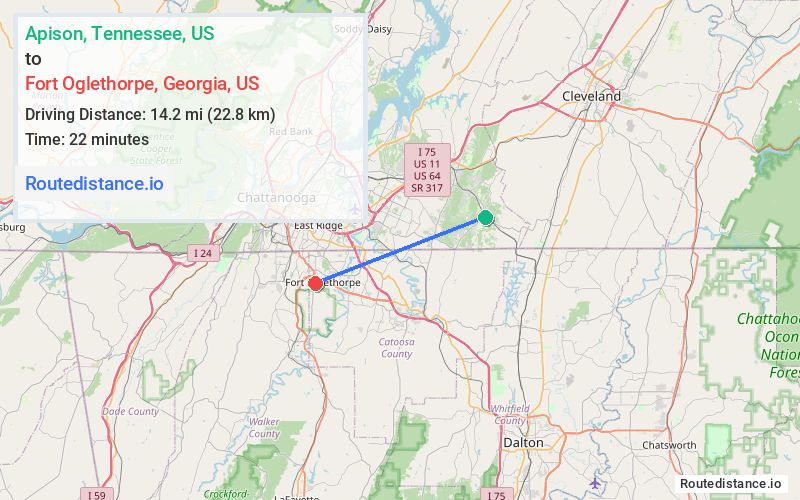
Distance from Apison, Tennessee to Fort Oglethorpe, Georgia
The driving distance from Apison, Tennessee to Fort Oglethorpe, Georgia is 22.3 mi (35.9 km)
The straight-line (air) distance is approximately 8.8 mi (14.2 km)
Estimated travel time by road is 32 minutes
We found 3 routes between Apison and Fort Oglethorpe.
Available Routes
Route Directions
Follow TN-317 W, I-75 S and GA-146 W/Cloud Springs Rd to Van Cleve St in Fort Oglethorpe
Follow Van Cleve St and Forrest Rd to Stephenson Dr
Route Directions
Take Cherokee Valley Rd to US-41 S/US-76 E in Catoosa County
Take I-75 N and GA-146 W/Cloud Springs Rd to Van Cleve St in Fort Oglethorpe
Follow Van Cleve St and Forrest Rd to Stephenson Dr
Route Directions
Take Cherokee Valley Rd to US-41 N/US-76 W in Catoosa County
Take GA-2/Battlefield Pkwy to Van Cleve St in Fort Oglethorpe
Follow Van Cleve St and Forrest Rd to Stephenson Dr
Journey Details
Traveling from Apison, Tennessee to Fort Oglethorpe, Georgia covers 20.5 miles (33 km) in a west direction. This secondary roads, moderate route typically takes 34 minutes under normal conditions.
Drivers have 3 route options between these locations (20-25 miles / 33-40 km). The primary route shown here saves no time compared to alternatives.
The route features scenic views. During night weekend travel, expect typical weekend traffic patterns with average speeds around 35 mph (56 km/h) .
Journey Waypoints
Apison
Starting Point
Fort Oglethorpe
Destination
Route Map Image