Distance from Cedar Level, Virginia to Hillsboro, Tennessee
The driving distance from Cedar Level, Virginia to Hillsboro, Tennessee is 618.7 mi (995.7 km)
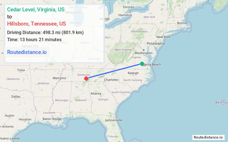
The straight-line (air) distance is approximately 309.6 mi (498.3 km)
Estimated travel time by road is 9 hours 45 minutes
This route includes Toll roads along the way.
We found 3 routes between Cedar Level and Hillsboro.
Available Routes
Route Directions
Get on I-85 S in Petersburg from VA-36 W
Follow I-85 S and I-40 to US-127 S in Crossville. Take exit 317 from I-40
Take US-70 W, US-70S W and TN-127 S to US-41 N in Hillsboro
Route Directions
Get on I-85 S in Petersburg from VA-36 W
Follow I-85 S and I-40 to US-74 W/Great Smoky Mountains Expy in Haywood County. Take exit 27 from I-40
Get on I-75 S in Cleveland from US-74 W
Follow I-75 S and I-24 W to TN-50 E in Pelham. Take exit 127 from I-24 W
Drive to US-41 N in Hillsboro
Route Directions
Get on I-295 N from Oaklawn Blvd/Woodlawn St
Follow I-64 W, I-81 S and I-40 to US-127 S in Crossville. Take exit 317 from I-40
Take US-70 W, US-70S W and TN-127 S to US-41 N in Hillsboro
Journey Details
Traveling from Cedar Level, Virginia to Hillsboro, Tennessee covers 614.1 miles (988 km) in a west direction. This highway, long-distance route typically takes 9 hours 21 minutes under normal conditions.
Drivers have 3 route options between these locations (614-619 miles / 988-996 km). The primary route shown here saves 35 minutes compared to alternatives.
The route features toll sections. During night weekday travel, expect minimal traffic congestion with average speeds around 64 mph (103 km/h) .
Journey Waypoints
Cedar Level
Starting Point
Hillsboro
Destination
Route Map Image