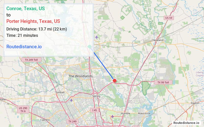
Distance from Conroe, Texas to Porter Heights, Texas
The driving distance from Conroe, Texas to Porter Heights, Texas is 16.1 mi (26 km)
The straight-line (air) distance is approximately 8.5 mi (13.7 km)
Estimated travel time by road is 25 minutes
We found 3 routes between Conroe and Porter Heights.
Available Routes
Route Directions
Take Conroe Porter Rd and FM1314 S to Gene Campbell Rd
Follow Porter Ln to Maple Hts Blvd in Porter Heights
Route Directions
Route Directions
Take Conroe Porter Rd and FM1314 S to Live Oak Estates Dr in Porter Heights
Take Porter Ln to Maple Hts Blvd
Journey Details
Traveling from Conroe, Texas to Porter Heights, Texas covers 16 miles (26 km) in a southeast direction. This secondary roads, moderate route typically takes 25 minutes under normal conditions.
Drivers have 3 route options between these locations (16-19 miles / 26-30 km). The primary route shown here saves 6 minutes compared to alternatives.
The route features scenic views. During midday weekday travel, expect lighter midday traffic with average speeds around 38 mph (61 km/h) .
Journey Waypoints
Conroe
Starting Point
Porter Heights
Destination
Route Map Image