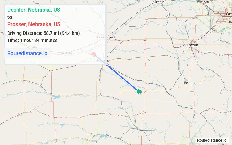
Distance from Deshler, Nebraska to Prosser, Nebraska
The driving distance from Deshler, Nebraska to Prosser, Nebraska is 84.3 mi (135.7 km)
The straight-line (air) distance is approximately 36.5 mi (58.7 km)
Estimated travel time by road is 1 hour 26 minutes
We found 3 routes between Deshler and Prosser.
Available Routes
Route Directions
Take 4th St to US Hwy 136 W
Continue on NE-4 W. Take NE-74 W to S Prosser Ave in Juniata Township
Follow S Prosser Ave to W Virginia Ave in Prosser
Route Directions
Take 4th St to US Hwy 136 W
Continue on NE-4 W. Take NE-74 W to S Showboat Blvd in Hanover Township
Continue on S Showboat Blvd to Hastings
Continue on W Rosedale Rd. Drive to W Virginia Ave in Prosser
Route Directions
Take 4th St to US Hwy 136 W
Continue on US Hwy 136 W. Take NE-4 W to Lorentz Ave/S Roseland Ave in Roseland Township
Follow S Prosser Ave to W Virginia Ave in Prosser
Journey Details
Traveling from Deshler, Nebraska to Prosser, Nebraska covers 83.1 miles (134 km) in a northwest direction. This highway, substantial route typically takes 1 hour 27 minutes under normal conditions.
Drivers have 3 route options between these locations (83-87 miles / 134-141 km). The primary route shown here saves 4 minutes compared to alternatives.
The route features scenic views. During morning weekday travel, expect morning rush hour with average speeds around 57 mph (92 km/h) .
Journey Waypoints
Deshler
Starting Point
Prosser
Destination
Route Map Image