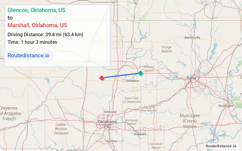
Distance from Glencoe, Oklahoma to Marshall, Oklahoma
The driving distance from Glencoe, Oklahoma to Marshall, Oklahoma is 50.7 mi (81.6 km)
The straight-line (air) distance is approximately 24.5 mi (39.4 km)
Estimated travel time by road is 58 minutes
We found 3 routes between Glencoe and Marshall.
Available Routes
Route Directions
Route Directions
Take US-64 W to Cedar St in Noble County
Follow OK-86 S to OK-51 W in Payne County
Follow OK-74E Spur N/MacArthur Blvd to E Main St in Marshall
Route Directions
Journey Details
Traveling from Glencoe, Oklahoma to Marshall, Oklahoma covers 50 miles (80 km) in a west direction. This mixed highways and local roads, moderate route typically takes 58 minutes under normal conditions.
Drivers have 3 route options between these locations (50-60 miles / 80-97 km). The primary route shown here saves 6 minutes compared to alternatives.
Journey Waypoints
Glencoe
Starting Point
Marshall
Destination
Route Map Image