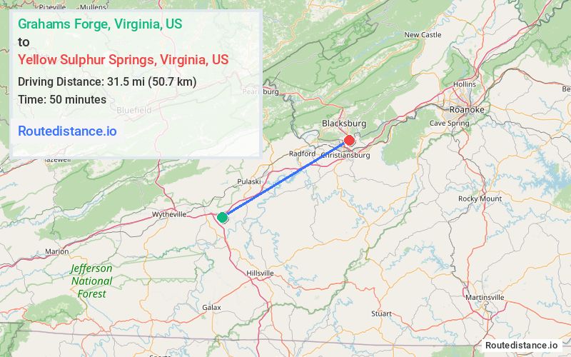
Distance from Grahams Forge, Virginia to Yellow Sulphur Springs, Virginia
The driving distance from Grahams Forge, Virginia to Yellow Sulphur Springs, Virginia is 41.4 mi (66.7 km)
The straight-line (air) distance is approximately 19.6 mi (31.5 km)
Estimated travel time by road is 41 minutes
We found 3 routes between Grahams Forge and Yellow Sulphur Springs.
Available Routes
Route Directions
Get on I-81 N/US-11 N
Continue on I-81 N to Montgomery County. Take exit 4B from US-460 W
Take Cinnabar Rd to your destination
Route Directions
Follow I-81 N and Cleburne Blvd to State Rte 627 in Pulaski County
Continue on State Rte 627 to VA-114 E/Five/Peppers Ferry Rd NW
Continue on VA-114 E/Peppers Ferry Rd NW to Merrimac
Continue on State Rte 642 to your destination
Route Directions
Get on I-81 N/US-11 N
Continue on I-81 N to Christiansburg. Take exit 3AB from US-460 W
Continue on US-460 BUS W to your destination
Journey Details
Traveling from Grahams Forge, Virginia to Yellow Sulphur Springs, Virginia covers 41.1 miles (66 km) in a northeast direction. This highway, moderate route typically takes 42 minutes under normal conditions.
Drivers have 3 route options between these locations (41-42 miles / 66-67 km). The primary route shown here saves 14 minutes compared to alternatives.
The route features scenic views. During night weekday travel, expect minimal traffic congestion with average speeds around 58 mph (93 km/h) .
Journey Waypoints
Grahams Forge
Starting Point
Yellow Sulphur Springs
Destination
Route Map Image