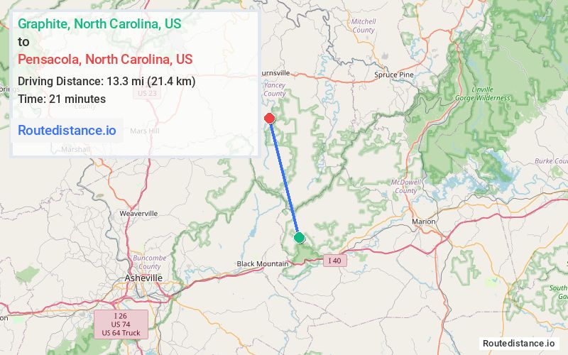
Distance from Graphite, North Carolina to Pensacola, North Carolina
The driving distance from Graphite, North Carolina to Pensacola, North Carolina is 65.2 mi (105 km)
The straight-line (air) distance is approximately 8.3 mi (13.3 km)
Estimated travel time by road is 1 hour 23 minutes
We found 2 routes between Graphite and Pensacola.
Available Routes
Route Directions
Get on I-40/US-70 W in Buncombe County from Mill Creek Rd
Continue on I-40. Take I-26 W/US-23 N to US-19 N/US-23 ALT N in Madison County. Take exit 9 from I-26 W/US-19 N/US-23 N
Continue on US-19 N. Take US-19E E to State Rd 1106 in Yancey County
Route Directions
Take Mill Creek Rd and State Rd 1400/Old US 70 W to US-70 E/W Main St in Old Fort
Continue on US-70 E to NC-226 N
Follow NC-226 N to US-19E W in Spruce Pine
Continue on US-19E W to Burnsville
Take Bolens Creek Rd and NC-197 S to State Rd 1106
Journey Details
Traveling from Graphite, North Carolina to Pensacola, North Carolina covers 52.5 miles (84 km) in a north direction. This mixed highways and local roads, moderate route typically takes 1 hour 20 minutes under normal conditions.
Drivers have 2 route options between these locations (52-65 miles / 84-105 km). The primary route shown here saves 3 minutes compared to alternatives.
Journey Waypoints
Graphite
Starting Point
Pensacola
Destination
Route Map Image