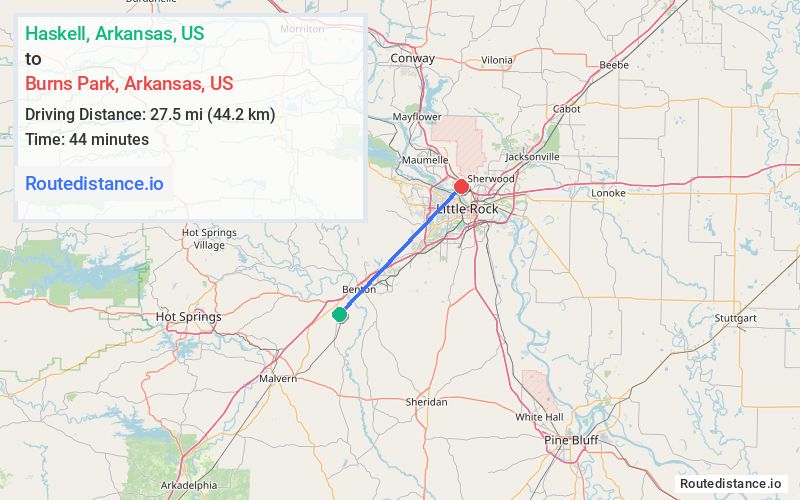
Distance from Haskell, Arkansas to Burns Park, Arkansas
The driving distance from Haskell, Arkansas to Burns Park, Arkansas is 36.2 mi (58.2 km)
The straight-line (air) distance is approximately 17.1 mi (27.5 km)
Estimated travel time by road is 37 minutes
This route includes Toll roads along the way.
We found 2 routes between Haskell and Burns Park.
Available Routes
Route Directions
Get on I-30 E in Benton
Follow I-30 E to Charles H Boyer Dr in North Little Rock. Take exit 150 from I-40 W/US-65 N
Take Military Dr and Arlene Laman Dr to your destination
Route Directions
Get on I-30 E in Benton
Continue on I-30 E. Take I-430 N to Military Dr in North Little Rock. Take exit 150 from I-40 E
Take Arlene Laman Dr to your destination
Journey Details
Traveling from Haskell, Arkansas to Burns Park, Arkansas covers 35.2 miles (57 km) in a northeast direction. This highway, moderate route typically takes 36 minutes under normal conditions.
Drivers have 2 route options between these locations (35-36 miles / 57-58 km). The primary route shown here saves 2 minutes compared to alternatives.
The route features toll sections. During morning weekend travel, expect typical weekend traffic patterns with average speeds around 61 mph (98 km/h) .
Journey Waypoints
Haskell
Starting Point
Burns Park
Destination
Route Map Image