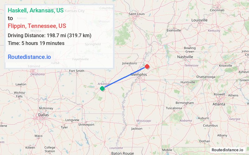
Distance from Haskell, Arkansas to Flippin, Tennessee
The driving distance from Haskell, Arkansas to Flippin, Tennessee is 279.2 mi (449.4 km)
The straight-line (air) distance is approximately 123.4 mi (198.7 km)
Estimated travel time by road is 4 hours 12 minutes
We found 3 routes between Haskell and Flippin.
Available Routes
Route Directions
Get on I-30 E in Benton
Continue on I-30 E. Take I-40 E, I-55 N and I-155 E/US-412 E to TN-78 S/Lake Rd in Dyersburg. Take exit 13 from I-155 E/US-412 E
Follow US-51 S to Roy Crain Rd in Lauderdale County
Route Directions
Get on I-30 E in Benton
Follow I-30 E and I-57/US-67 N to US-412 E in Walnut Ridge. Take the US-412 exit from I-57/US-67 N
Continue to Hayti Township
Follow I-155 E/US-412 E to TN-78 S/Lake Rd in Dyersburg. Take exit 13 from I-155 E/US-412 E
Follow US-51 S to Roy Crain Rd in Lauderdale County
Route Directions
Get on I-30 E in Benton
Follow I-30 E and I-40 E to US-51 N/Hwy 51 S/Thomas St in Memphis. Take the US-51 N exit from I-69
Follow US-51 N/Hwy 51 S to Roy Crain Rd in Lauderdale County
Journey Details
Traveling from Haskell, Arkansas to Flippin, Tennessee covers 221.5 miles (356 km) in a east direction. This highway, long-distance route typically takes 3 hours 38 minutes under normal conditions.
Drivers have 3 route options between these locations (222-279 miles / 356-449 km). The primary route shown here saves 43 minutes compared to alternatives.
Journey Waypoints
Haskell
Starting Point
Flippin
Destination
Route Map Image