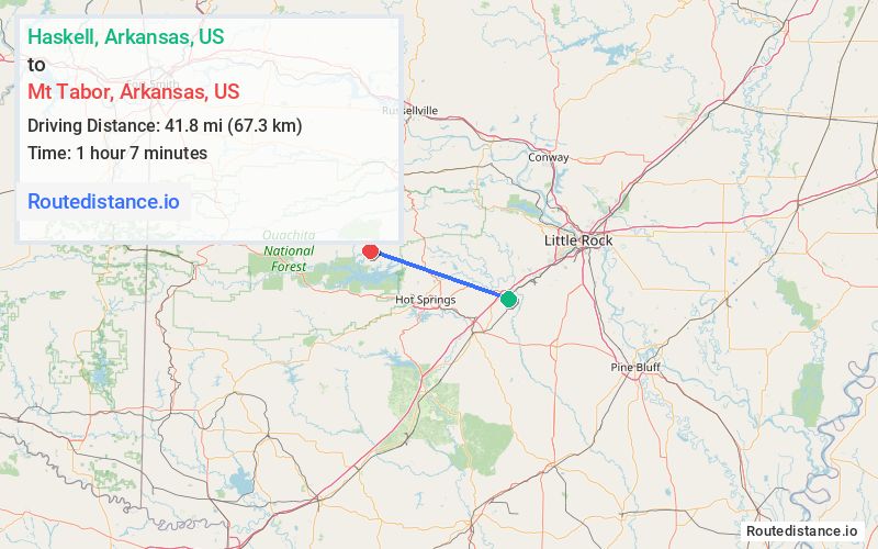
Distance from Haskell, Arkansas to Mt Tabor, Arkansas
The driving distance from Haskell, Arkansas to Mt Tabor, Arkansas is 58.8 mi (94.7 km)
The straight-line (air) distance is approximately 26 mi (41.8 km)
Estimated travel time by road is 1 hour 11 minutes
We found 3 routes between Haskell and Mt Tabor.
Available Routes
Route Directions
Take US-70 W, AR-5/Hwy 5, AR 7 N/N Hwy 7 and AR-298 W to Tabor Mountain Rd in Garland County
Drive to Tabor Mountain Rd
Route Directions
Continue on US-67 S. Take I-30 W, US-270 W and AR-5 to AR 7 N/N Hwy 7 in Garland County
Follow AR 7 N/N Hwy 7 and AR-298 W to Tabor Mountain Rd
Route Directions
Take US-70 W, AR-128 W, AR 7 N/N Hwy 7 and AR-298 W to Tabor Mountain Rd in Garland County
Drive to Tabor Mountain Rd
Journey Details
Traveling from Haskell, Arkansas to Mt Tabor, Arkansas covers 55.3 miles (89 km) in a west direction. This mixed highways and local roads, moderate route typically takes 1 hour 10 minutes under normal conditions.
Drivers have 3 route options between these locations (55-66 miles / 89-106 km). The primary route shown here saves 9 minutes compared to alternatives.
The route features scenic views. During midday weekday travel, expect lighter midday traffic with average speeds around 49 mph (79 km/h) .
Journey Waypoints
Haskell
Starting Point
Mt Tabor
Destination
Route Map Image