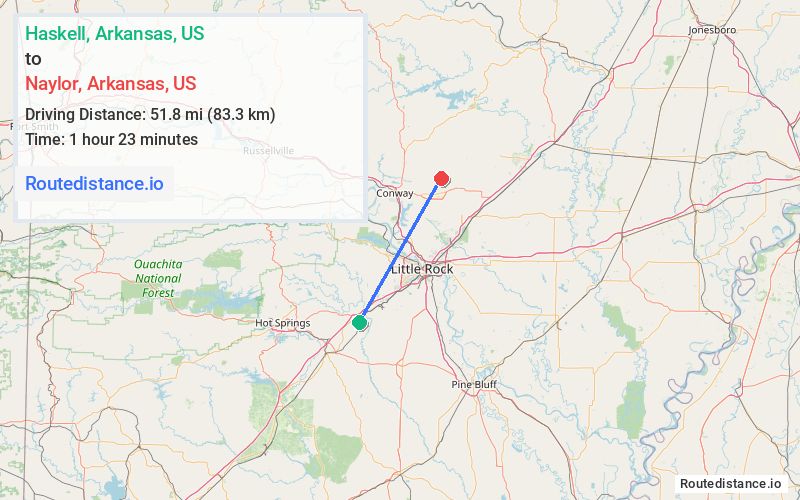
Distance from Haskell, Arkansas to Naylor, Arkansas
The driving distance from Haskell, Arkansas to Naylor, Arkansas is 69.6 mi (112.1 km)
The straight-line (air) distance is approximately 32.2 mi (51.8 km)
Estimated travel time by road is 1 hour 15 minutes
We found 2 routes between Haskell and Naylor.
Available Routes
Route Directions
Get on I-30 E in Benton
Follow I-30 E and I-57/US-167 N/US-67 N to AR-5 N in Cabot. Take exit 16B from I-57/US-167 N/US-67 N
Continue on AR-5 N. Drive to Charles Rd S in Faulkner County
Route Directions
Get on I-30 E in Benton
Follow I-30 E, I-430 N and I-40 W to US-64 E/E Oak St/U.S. Hwy 64 E in Conway. Take exit 127 from I-40 W
Follow US-64 E/U.S. Hwy 64 E and AR-36 E to Charles Rd S
Journey Details
Traveling from Haskell, Arkansas to Naylor, Arkansas covers 69.6 miles (112 km) in a northeast direction. This highway, substantial route typically takes 1 hour 9 minutes under normal conditions.
Drivers have 2 route options between these locations (70-70 miles / 112-112 km). The primary route shown here saves 6 minutes compared to alternatives.
The route features scenic views. During midday weekday travel, expect lighter midday traffic with average speeds around 62 mph (100 km/h) .
Journey Waypoints
Haskell
Starting Point
Naylor
Destination
Route Map Image