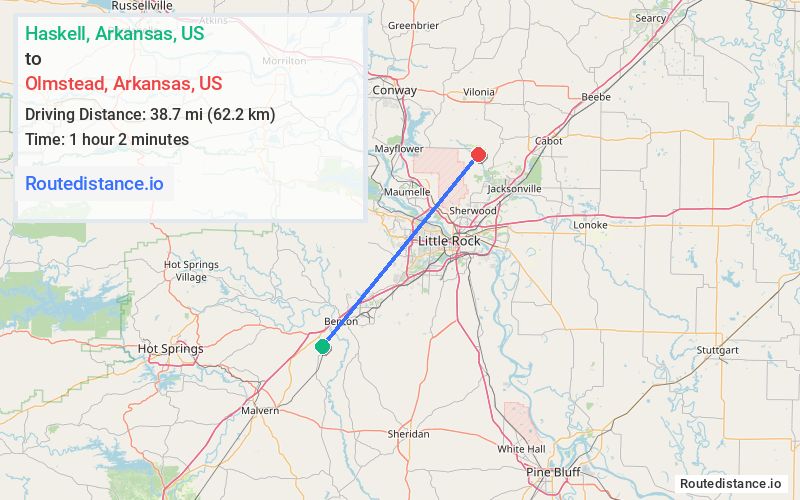
Distance from Haskell, Arkansas to Olmstead, Arkansas
The driving distance from Haskell, Arkansas to Olmstead, Arkansas is 45.6 mi (73.4 km)
The straight-line (air) distance is approximately 24 mi (38.7 km)
Estimated travel time by road is 53 minutes
We found 2 routes between Haskell and Olmstead.
Available Routes
Route Directions
Get on I-30 E in Benton
Follow I-30 E to W 33rd St in North Little Rock. Take exit 152A from I-40 W/US-65 N
Take Remount Rd and Batesville Pike to Fortson Rd
Route Directions
Get on I-30 E in Benton
Follow I-30 E to AR-107 N/John F Kennedy Blvd in North Little Rock. Take exit 143A from I-30 E
Continue on AR-107 N. Take Batesville Pike to Fortson Rd
Journey Details
Traveling from Haskell, Arkansas to Olmstead, Arkansas covers 45.4 miles (73 km) in a northeast direction. This mixed highways and local roads, moderate route typically takes 55 minutes under normal conditions.
Drivers have 2 route options between these locations (45-46 miles / 73-73 km). The primary route shown here saves no time compared to alternatives.
The route features scenic views. During night weekday travel, expect minimal traffic congestion with average speeds around 51 mph (82 km/h) .
Journey Waypoints
Haskell
Starting Point
Olmstead
Destination
Route Map Image